
Magnitude |
:2.6 |
| Date & Time (UTC) | 2008-09-07 16:54:01.9 |
| Date & Time (Local) | 1387/6/17 21:24:01.9 |
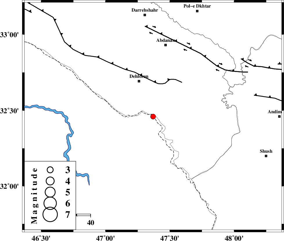
| Location | Lat:32.46 Lon: 47.37 |
| Region | 28 km South-East of Dehloran, Ilam Province |
Nearest Cities |
|
| 10 km of Musian, Ilam Province | |
| 28 km South East of Dehloran, Ilam Province | |
| 52 km South West of Sarabbagh, Ilam Province | |
| 53 km South of Abdanan, Ilam Province | |
| 55 km South East of Bishehzar, Ilam Province | |
| Depth | 14 km |
| Agency | |
Faults within 150 km: |
|
| MFF6 (Length: 144 km) , Distance to epicenter: 24 km | |
| BALARUD_F_Z1 (Length: 87 km) , Distance to epicenter: 58 km | |
| DEZFUL_EMBAYMENT (Length: 228 km) , Distance to epicenter: 75 km | |
| Number of Phases | 6 |
| RMS | 0.1 |
| Number of Stations | 4 |
| Error in Latitude | >4.2 km |
| Error in Longitude | 6.7 km |
| Error in Depth | 5 km |
Download waveform in seisan format
to download seisan software Click here
to access information about IIEES stations Click here
Amplitude | ||||||||
| UID | Agency | Station | Component | Amplitude | Period | Arrival Time | Proccessing Time | Signal Clip |
| 50165 | IIEES | ASAO | E | 18 | 0.56 | 2008-09-07 16:55:47 | 2009-05-05 01:27:00 | n |
| 50166 | IIEES | ASAO | N | 16.8 | 0.56 | 2008-09-07 16:55:54 | 2009-05-05 01:27:00 | n |
| 50167 | IIEES | GHVR | N | 10.2 | 0.68 | 2008-09-07 16:55:58 | 2009-05-05 01:27:00 | n |
| 50168 | IIEES | GHVR | E | 8.5 | 0.4 | 2008-09-07 16:55:59 | 2009-05-05 01:27:00 | n |
Phase | ||||||||||||
| Agency | Station | Component | Phase Type | Phase Quality | First Motion | Observed Arrival Time | Time Residual | Loc. Flag | Input Weight | Distance | Azimuth | |
| IIEES | SHGR | Z | Pg | E | 2008-09-07 16:54:25 | -0.2 | y | 140 | 106 | |||
| IIEES | SHGR | N | Sg | E | 2008-09-07 16:54:42 | 0.1 | y | 140 | 106 | |||
| IIEES | SNGE | Z | Pn | E | 2008-09-07 16:54:46 | 0.1 | y | 292 | 360 | |||
| IIEES | SNGE | E | Sg | E | 2008-09-07 16:55:24 | -0.1 | y | 292 | 360 | |||
| IIEES | ASAO | Z | Pn | E | 2008-09-07 16:54:51 | 0.1 | y | 338 | 46 | |||
| IIEES | GHVR | Z | Pn | E | 2008-09-07 16:55:02 | 0 | y | 424 | 57 | |||