
Magnitude |
:3.1 |
| Date & Time (UTC) | 2008-09-06 02:29:03.6 |
| Date & Time (Local) | 1387/6/16 06:59:03.6 |
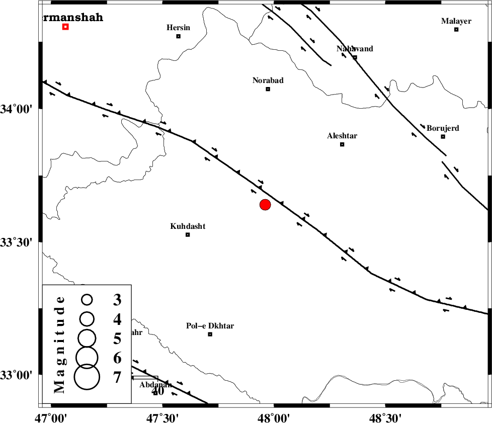
| Location | Lat:33.64 Lon: 47.96 |
| Region | 34 km North-East of Kuhdasht, Lorestan Province |
Nearest Cities |
|
| 12 km North of Sarabboreh, Lorestan Province | |
| 18 km North of Mahmudvand, Lorestan Province | |
| 27 km North West of Godar-e mahmudvand, Lorestan Province | |
| 30 km North of Maeulan, Lorestan Province | |
| 33 km South West of Firuz Abad, Lorestan Province | |
| Depth | 18 km |
| Agency | |
Faults within 150 km: |
|
| HZF4 (Length: 492 km) , Distance to epicenter: 10 km | |
| SAHANEH_F (Length: 77 km) , Distance to epicenter: 64 km | |
| NAHAVAND_F (Length: 102 km) , Distance to epicenter: 67 km | |
| Number of Phases | 7 |
| RMS | 0.1 |
| Number of Stations | 6 |
| Error in Latitude | >2.2 km |
| Error in Longitude | 6.7 km |
| Error in Depth | 8.7 km |
Download waveform in seisan format
to download seisan software Click here
to access information about IIEES stations Click here
Amplitude | ||||||||
| UID | Agency | Station | Component | Amplitude | Period | Arrival Time | Proccessing Time | Signal Clip |
| 50146 | IIEES | SNGE | E | 472 | 0.52 | 2008-09-06 02:30:03 | 2009-05-05 01:27:00 | n |
| 50147 | IIEES | SHGR | N | 301.2 | 0.52 | 2008-09-06 02:30:03 | 2009-05-05 01:27:00 | n |
| 50148 | IIEES | ZNJK | E | 25.6 | 0.53 | 2008-09-06 02:30:42 | 2009-05-05 01:27:00 | n |
Phase | ||||||||||||
| Agency | Station | Component | Phase Type | Phase Quality | First Motion | Observed Arrival Time | Time Residual | Loc. Flag | Input Weight | Distance | Azimuth | |
| IIEES | SNGE | Z | Pg | E | 2008-09-06 02:29:32 | 0.2 | y | 171 | 341 | |||
| IIEES | SNGE | E | Sg | E | 2008-09-06 02:29:52 | -0.1 | y | 171 | 341 | |||
| IIEES | SHGR | Z | Pn | E | 2008-09-06 02:29:34 | -0.1 | y | 187 | 155 | |||
| IIEES | ZNJK | Z | Pn | E | 2008-09-06 02:29:53 | -0.1 | y | 343 | 11 | |||
| IIEES | CHTH | Z | Pn | E | 2008-09-06 02:29:58 | -0.1 | y | 384 | 48 | |||
| IIEES | DAMV | Z | Pn | E | 2008-09-06 02:30:04 | 0.1 | y | 429 | 58 | |||
| IIEES | NASN | Z | Pn | E | 2008-09-06 02:30:08 | 0.1 | y | 462 | 100 | |||