
Magnitude |
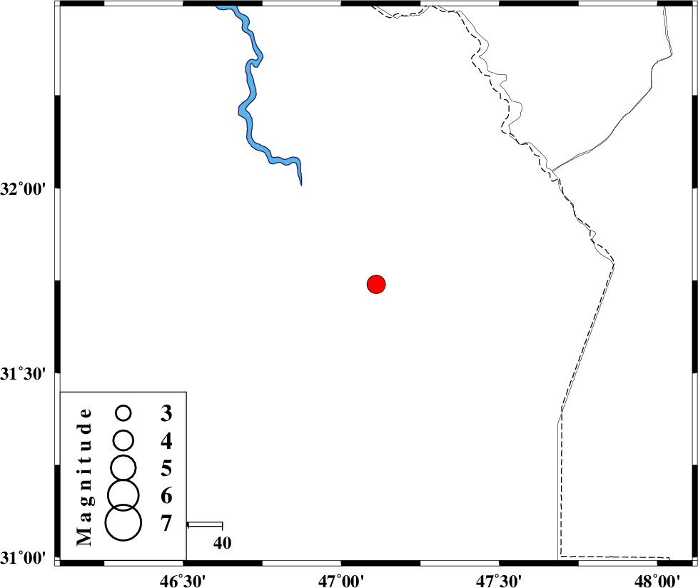
:3.6 |
| Date & Time (UTC) | 2008-09-02 21:06:05.9 |
| Date & Time (Local) | 1387/6/13 01:36:05.9 |
| Location | Lat:31.74 Lon: 47.11 |
| Region | 104 km North-West of Susangerd, Khoozestan Province |
Nearest Cities |
|
| 83 km North West of Bostan, Khoozestan Province | |
| 93 km South West of Musian, Ilam Province | |
| 97 km North West of Hoveizeh, Khoozestan Province | |
| 104 km North West of Susangerd, Khoozestan Province | |
| 107 km South West of Dehloran, Ilam Province | |
| Depth | 14 km |
| Agency | |
Faults within 150 km: |
|
| AHVAZ_F (Length: 99 km) , Distance to epicenter: 101 km | |
| MFF6 (Length: 144 km) , Distance to epicenter: 108 km | |
| BALARUD_F_Z1 (Length: 87 km) , Distance to epicenter: 137 km | |
| Number of Phases | 5 |
| RMS | 0 |
| Number of Stations | 4 |
| Error in Latitude | >7.5 km |
| Error in Longitude | 4.7 km |
| Error in Depth | 5.9 km |
Download waveform in seisan format
to download seisan software Click here
to access information about IIEES stations Click here
Amplitude | ||||||||
| UID | Agency | Station | Component | Amplitude | Period | Arrival Time | Proccessing Time | Signal Clip |
| 50109 | IIEES | SHGR | N | 2295.7 | 0.22 | 2008-09-02 21:06:55 | 2009-05-05 01:27:00 | n |
| 50110 | IIEES | ASAO | E | 47 | 0 | 2008-09-02 21:08:00 | 2009-05-05 01:27:00 | n |
| 50111 | IIEES | GHVR | E | 45.8 | 0.46 | 2008-09-02 21:08:16 | 2009-05-05 01:27:00 | n |
Phase | ||||||||||||
| Agency | Station | Component | Phase Type | Phase Quality | First Motion | Observed Arrival Time | Time Residual | Loc. Flag | Input Weight | Distance | Azimuth | |
| IIEES | SHGR | Z | Pg | E | 2008-09-02 21:06:33 | 0 | y | 166 | 75 | |||
| IIEES | SHGR | N | Sg | E | 2008-09-02 21:06:53 | 0 | y | 166 | 75 | |||
| IIEES | ASAO | Z | Pn | E | 2008-09-02 21:07:05 | 0 | y | 414 | 40 | |||
| IIEES | GHVR | Z | Pn | E | 2008-09-02 21:07:14 | 0 | y | 492 | 51 | |||
| IIEES | NASN | Z | Pn | E | 2008-09-02 21:07:22 | 0.1 | y | 550 | 76 | |||