
Magnitude |
:2.8 |
| Date & Time (UTC) | 2008-07-05 13:15:30.0 |
| Date & Time (Local) | 1387/4/15 17:45:30.0 |
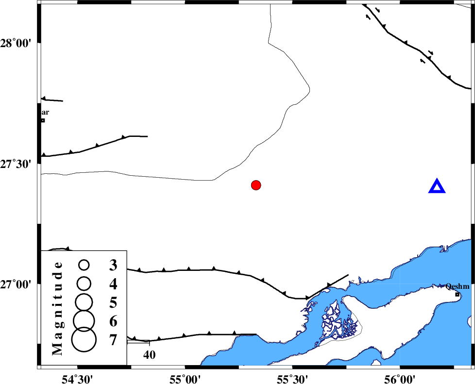
| Location | Lat:27.41 Lon: 55.33 |
| Region | 97 km North-West of Bandar-e abbas, Hormozgan Province |
Nearest Cities |
|
| 51 km South of Darz, Fars Province | |
| 57 km North West of Bandar-e khamir, Hormozgan Province | |
| 62 km South West of Fin, Hormozgan Province | |
| 90 km South East of Fadami, Fars Province | |
| 97 km North West of Bandar-e abbas, Hormozgan Province | |
| Depth | 18 km |
| Agency | |
Faults within 150 km: |
|
| MFF1 (Length: 180 km) , Distance to epicenter: 42 km | |
| LAR_F (Length: 99 km) , Distance to epicenter: 55 km | |
| ZFF1 (Length: 165 km) , Distance to epicenter: 69 km | |
| Number of Phases | 4 |
| RMS | 0 |
| Number of Stations | 3 |
| Error in Latitude | >2 km |
| Error in Longitude | 3.5 km |
| Error in Depth | 6.1 km |
Download waveform in seisan format
to download seisan software Click here
to access information about IIEES stations Click here
Amplitude | ||||||||
| UID | Agency | Station | Component | Amplitude | Period | Arrival Time | Proccessing Time | Signal Clip |
| 49531 | IIEES | GHIR | N | 49.4 | 0.44 | 2008-07-05 13:16:55 | 2009-05-05 01:27:00 | n |
| 49532 | IIEES | GHIR | E | 52.5 | 0.48 | 2008-07-05 13:16:56 | 2009-05-05 01:27:00 | n |
| 49533 | IIEES | KRBR | N | 38.2 | 0.32 | 2008-07-05 13:17:00 | 2009-05-05 01:27:00 | n |
| 49534 | IIEES | KRBR | E | 22.5 | 0.32 | 2008-07-05 13:17:02 | 2009-05-05 01:27:00 | n |
Phase | ||||||||||||
| Agency | Station | Component | Phase Type | Phase Quality | First Motion | Observed Arrival Time | Time Residual | Loc. Flag | Input Weight | Distance | Azimuth | |
| IIEES | BNDS | Z | Pg | E | 2008-07-05 13:15:44 | 0 | y | 83.5 | 90 | |||
| IIEES | GHIR | Z | Pn | E | 2008-07-05 13:16:08 | 0 | y | 250 | 293 | |||
| IIEES | KRBR | Z | Pn | E | 2008-07-05 13:16:16 | -0.1 | y | 318 | 26 | |||
| IIEES | KRBR | N | Sg | E | 2008-07-05 13:16:59 | 0 | y | 318 | 26 | |||