
Magnitude |
:2.8 |
| Date & Time (UTC) | 2008-04-30 01:29:08.6 |
| Date & Time (Local) | 1387/2/11 05:59:08.6 |
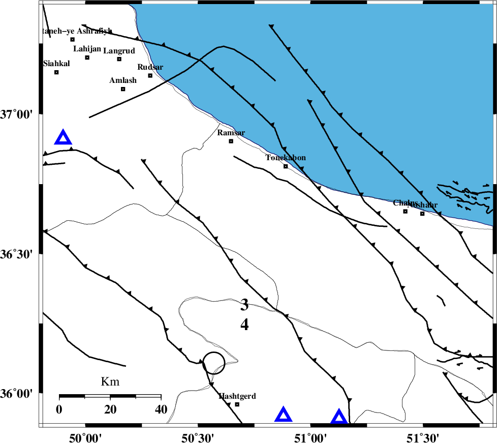
| Location | Lat:36.64 Lon: 50.81 |
| Region | 20 km South of Tonekabon, Mazandaran Province |
Nearest Cities |
|
| 17 km South of Soleymanabad, Mazandaran Province | |
| 17 km West of Kanza, Mazandaran Province | |
| 18 km South of Khorramabad, Mazandaran Province | |
| 21 km South of Tonekabon, Mazandaran Province | |
| 28 km West of Abbasabad, Mazandaran Province | |
| Depth | 14 km |
| Agency | |
Faults within 150 km: |
|
| BONAN_F (Length: 74 km) , Distance to epicenter: 10 km | |
| N_ALBORZ_F (Length: 360 km) , Distance to epicenter: 15 km | |
| KHAZAR_F (Length: 523 km) , Distance to epicenter: 15 km | |
| Number of Phases | 5 |
| RMS | 0.2 |
| Number of Stations | 5 |
| Error in Latitude | >9.7 km |
| Error in Longitude | 7.9 km |
| Error in Depth | 8.9 km |
Download waveform in seisan format
to download seisan software Click here
to access information about IIEES stations Click here
Amplitude | ||||||||
| UID | Agency | Station | Component | Amplitude | Period | Arrival Time | Proccessing Time | Signal Clip |
| 49025 | IIEES | THKV | N | 495.6 | 0.26 | 2008-04-30 01:29:34 | 2009-01-18 12:56:00 | n |
| 49026 | IIEES | THKV | E | 533.2 | 0.39 | 2008-04-30 01:29:34 | 2009-01-18 12:56:00 | n |
| 49027 | IIEES | ZNJK | N | 80.6 | 0.34 | 2008-04-30 01:30:04 | 2009-01-18 12:56:00 | n |
Phase | ||||||||||||
| Agency | Station | Component | Phase Type | Phase Quality | First Motion | Observed Arrival Time | Time Residual | Loc. Flag | Input Weight | Distance | Azimuth | |
| IIEES | THKV | Z | Pg | E | 2008-04-30 01:29:22 | 0 | y | 80.3 | 176 | |||
| IIEES | CHTH | Z | Pg | E | 2008-04-30 01:29:23 | -0.3 | y | 85.7 | 161 | |||
| IIEES | DAMV | Z | Pg | E | 2008-04-30 01:29:34 | 0.1 | y | 153 | 137 | |||
| IIEES | ZNJK | Z | Pg | E | 2008-04-30 01:29:39 | -0.1 | y | 190 | 272 | |||
| IIEES | ASAO | Z | Pn | E | 2008-04-30 01:29:46 | 0.3 | y | 242 | 197 | |||