
Magnitude |
:3.8 |
| Date & Time (UTC) | 2008-02-28 10:42:09.1 |
| Date & Time (Local) | 1386/12/9 14:12:09.1 |
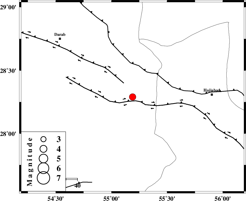
| Location | Lat:28.29 Lon: 55.19 |
| Region | 69 km West of Hajiabad, Hormozgan Province |
Nearest Cities |
|
| 2 km of Doborji, Fars Province | |
| 9 km North of Fadami, Fars Province | |
| 21 km South East of Rostaq, Fars Province | |
| 34 km South West of Tal bargah, Fars Province | |
| 53 km North West of Darz, Fars Province | |
| Depth | 18 km |
| Agency | |
Faults within 150 km: |
|
| HZF2 (Length: 437 km) , Distance to epicenter: 4 km | |
| HZF1 (Length: 102 km) , Distance to epicenter: 14 km | |
| MAIN_ZAGROS_R_F (Length: 1106 km) , Distance to epicenter: 25 km | |
| Number of Phases | 5 |
| RMS | 0 |
| Number of Stations | 4 |
| Error in Latitude | >1.5 km |
| Error in Longitude | 1.6 km |
| Error in Depth | 3.3 km |
Download waveform in seisan format
to download seisan software Click here
to access information about IIEES stations Click here
Amplitude | ||||||||
| UID | Agency | Station | Component | Amplitude | Period | Arrival Time | Proccessing Time | Signal Clip |
| 48349 | IIEES | BNDS | N | 1904.3 | 0.38 | 2008-02-28 10:42:57 | 2008-12-28 01:25:00 | n |
| 48350 | IIEES | GHIR | E | 657.3 | 0.49 | 2008-02-28 10:43:23 | 2008-12-28 01:25:00 | n |
| 48351 | IIEES | KRBR | N | 791.8 | 0.54 | 2008-02-28 10:43:25 | 2008-12-28 01:25:00 | n |
| 48352 | IIEES | KRBR | E | 755.9 | 0.54 | 2008-02-28 10:43:27 | 2008-12-28 01:25:00 | n |
Phase | ||||||||||||
| Agency | Station | Component | Phase Type | Phase Quality | First Motion | Observed Arrival Time | Time Residual | Loc. Flag | Input Weight | Distance | Azimuth | |
| IIEES | BNDS | Z | Pg | E | 2008-02-28 10:42:32 | 0 | y | 138 | 135 | |||
| IIEES | GHIR | Z | Pg | E | 2008-02-28 10:42:44 | 0 | y | 216 | 270 | |||
| IIEES | KRBR | Z | Pn | E | 2008-02-28 10:42:46 | -0.1 | y | 242 | 39 | |||
| IIEES | KRBR | E | Sg | E | 2008-02-28 10:43:17 | 0 | y | 242 | 39 | |||
| IIEES | ZHSF | Z | Pn | E | 2008-02-28 10:43:26 | 0 | y | 564 | 74 | |||