
Magnitude |
:3.2 |
| Date & Time (UTC) | 2008-01-11 05:55:16.5 |
| Date & Time (Local) | 1386/10/21 09:25:16.5 |
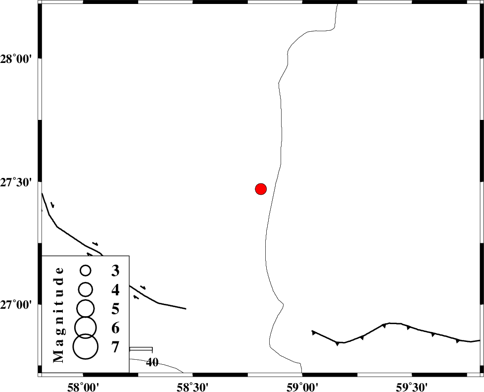
| Location | Lat:27.47 Lon: 58.81 |
| Region | 121 km South-East of Kahnuj, Kerman Province |
Nearest Cities |
|
| 62 km North West of Kalemursi, Sistan va Baloochestan Province | |
| 68 km South East of Borj-e abbasabad, Kerman Province | |
| 71 km North of Ramashk, Kerman Province | |
| 92 km East of Qalehy-eganj, Kerman Province | |
| 97 km North East of Keshmiran, Kerman Province | |
| Depth | 18 km |
| Agency | |
Faults within 150 km: |
|
| JIROFT_F (Length: 144 km) , Distance to epicenter: 64 km | |
| S_JAZMURIAN_F (Length: 91 km) , Distance to epicenter: 68 km | |
| BAM_F (Length: 118 km) , Distance to epicenter: 89 km | |
| Number of Phases | 4 |
| RMS | 0.1 |
| Number of Stations | 3 |
| Error in Latitude | >6.5 km |
| Error in Longitude | 4.1 km |
| Error in Depth | 14.2 km |
Download waveform in seisan format
to download seisan software Click here
to access information about IIEES stations Click here
Amplitude | ||||||||
| UID | Agency | Station | Component | Amplitude | Period | Arrival Time | Proccessing Time | Signal Clip |
| 47853 | IIEES | BNDS | N | 187.2 | 0.16 | 2008-01-11 05:56:26 | 2008-12-28 01:25:00 | n |
| 47854 | IIEES | KRBR | E | 48.5 | 0.32 | 2008-01-11 05:57:04 | 2008-12-28 01:25:00 | n |
Phase | ||||||||||||
| Agency | Station | Component | Phase Type | Phase Quality | First Motion | Observed Arrival Time | Time Residual | Loc. Flag | Input Weight | Distance | Azimuth | |
| IIEES | BNDS | Z | Pn | E | 2008-01-11 05:55:56 | 0 | y | 261 | 269 | |||
| IIEES | ZHSF | Z | P | E | 2008-01-11 05:56:01 | 0 | y | 306 | 39 | |||
| IIEES | KRBR | Z | Pn | E | 2008-01-11 05:56:06 | -0.1 | y | 343 | 325 | |||
| IIEES | KRBR | N | Sg | E | 2008-01-11 05:56:52 | 0 | y | 343 | 325 | |||