
Magnitude |
:3.3 |
| Date & Time (UTC) | 2007-11-18 07:33:33.2 |
| Date & Time (Local) | 1386/8/27 11:03:33.2 |
| Location | Lat:28.23 Lon: 53.96 |
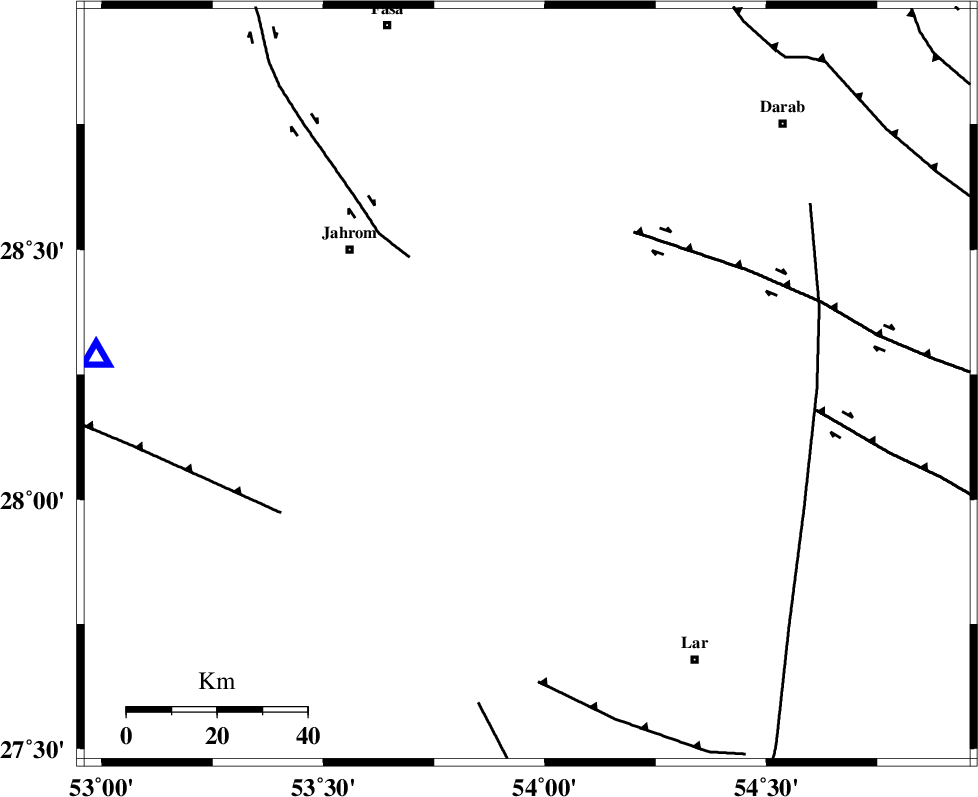
| Region | 49 km South-East of Jahrom, Fars Province |
Nearest Cities |
|
| 10 km North of Juyam, Fars Province | |
| 31 km South West of Dabiran, Fars Province | |
| 34 km South East of Khorramabad, Fars Province | |
| 37 km North East of Balafan, Fars Province | |
| 38 km North East of Kureh, Fars Province | |
| Depth | 46 km |
| Agency | |
Faults within 150 km: |
|
| BERIZ_F (Length: 49 km) , Distance to epicenter: 36 km | |
| QIR_F (Length: 130 km) , Distance to epicenter: 56 km | |
| LAR_F (Length: 99 km) , Distance to epicenter: 64 km | |
| Number of Phases | 5 |
| RMS | 0.2 |
| Number of Stations | 4 |
| Error in Latitude | >7.3 km |
| Error in Longitude | 4.2 km |
| Error in Depth | 6.7 km |
Download waveform in seisan format
to download seisan software Click here
to access information about IIEES stations Click here
Amplitude | ||||||||
| UID | Agency | Station | Component | Amplitude | Period | Arrival Time | Proccessing Time | Signal Clip |
| 40116 | IIEES | GHIR | N | 785.9 | 0.47 | 2007-11-18 07:34:16 | 2008-04-12 10:47:00 | n |
| 40117 | IIEES | BNDS | E | 210.6 | 0.83 | 2007-11-18 07:34:45 | 2008-04-12 10:47:00 | n |
| 40118 | IIEES | KRBR | N | 74 | 0.55 | 2007-11-18 07:35:09 | 2008-04-12 10:47:00 | n |
| 40119 | IIEES | KRBR | E | 83.3 | 0.41 | 2007-11-18 07:35:12 | 2008-04-12 10:47:00 | n |
Phase | ||||||||||||
| Agency | Station | Component | Phase Type | Phase Quality | First Motion | Observed Arrival Time | Time Residual | Loc. Flag | Input Weight | Distance | Azimuth | |
| IIEES | GHIR | Z | Pg | E | 2007-11-18 07:33:50 | 0.1 | y | 96 | 274 | |||
| IIEES | BNDS | Z | Pn | E | 2007-11-18 07:34:07 | -0.1 | y | 236 | 112 | |||
| IIEES | BNDS | N | Sg | E | 2007-11-18 07:34:39 | 0 | y | 236 | 112 | |||
| IIEES | KRBR | Z | Pn | E | 2007-11-18 07:34:20 | 0.3 | y | 334 | 54 | |||
| IIEES | NASN | Z | P | E | 2007-11-18 07:34:42 | -0.3 | y | 519 | 348 | |||