
Magnitude |
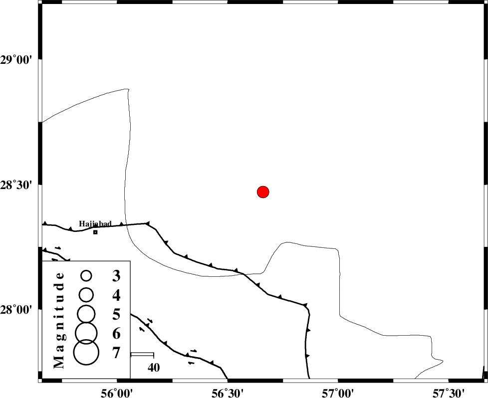
:3.4 |
| Date & Time (UTC) | 2007-08-29 04:20:08.9 |
| Date & Time (Local) | 1386/6/7 07:50:08.9 |
| Location | Lat:28.47 Lon: 56.66 |
| Region | 76 km North-East of Hajiabad, Hormozgan Province |
Nearest Cities |
|
| 26 km North West of Sarkhan, Kerman Province | |
| 27 km North East of Shahmaran, Kerman Province | |
| 29 km North East of Arzuieeh, Kerman Province | |
| 49 km South West of Dolatabad, Kerman Province | |
| 55 km South of Kashkueyeh, Kerman Province | |
| Depth | 14 km |
| Agency | |
Faults within 150 km: |
|
| MAIN_ZAGROS_R_F (Length: 1106 km) , Distance to epicenter: 37 km | |
| HZF2 (Length: 437 km) , Distance to epicenter: 79 km | |
| ZENDAN_MINAB_F_Z1 (Length: 183 km) , Distance to epicenter: 96 km | |
| Number of Phases | 6 |
| RMS | 0.1 |
| Number of Stations | 3 |
| Error in Latitude | >2 km |
| Error in Longitude | 1.2 km |
| Error in Depth | 4.2 km |
Download waveform in seisan format
to download seisan software Click here
to access information about IIEES stations Click here
Amplitude | ||||||||
| UID | Agency | Station | Component | Amplitude | Period | Arrival Time | Proccessing Time | Signal Clip |
| 39573 | IIEES | KRBR | E | 453.3 | 0.64 | 2007-08-29 04:21:14 | 2007-11-04 01:43:00 | n |
| 39574 | IIEES | GHIR | E | 77.9 | 0.48 | 2007-08-29 04:22:02 | 2007-11-04 01:43:00 | n |
| 39575 | IIEES | GHIR | N | 104.3 | 0.52 | 2007-08-29 04:22:14 | 2007-11-04 01:43:00 | n |
Phase | ||||||||||||
| Agency | Station | Component | Phase Type | Phase Quality | First Motion | Observed Arrival Time | Time Residual | Loc. Flag | Input Weight | Distance | Azimuth | |
| IIEES | KRBR | Z | Pg | E | 2007-08-29 04:20:36 | -0.1 | y | 168 | 3 | |||
| IIEES | KRBR | E | Sg | E | 2007-08-29 04:20:57 | 0 | y | 168 | 3 | |||
| IIEES | GHIR | Z | Pn | E | 2007-08-29 04:21:01 | 0 | y | 360 | 268 | |||
| IIEES | GHIR | N | Sg | E | 2007-08-29 04:21:49 | 0 | y | 360 | 268 | |||
| IIEES | ZHSF | Z | Pn | E | 2007-08-29 04:21:09 | 0.2 | y | 420 | 72 | |||
| IIEES | ZHSF | N | Sg | E | 2007-08-29 04:22:06 | -0.1 | y | 420 | 72 | |||