
Magnitude |
:2.9 |
| Date & Time (UTC) | 2007-08-27 07:56:09.3 |
| Date & Time (Local) | 1386/6/5 11:26:09.3 |
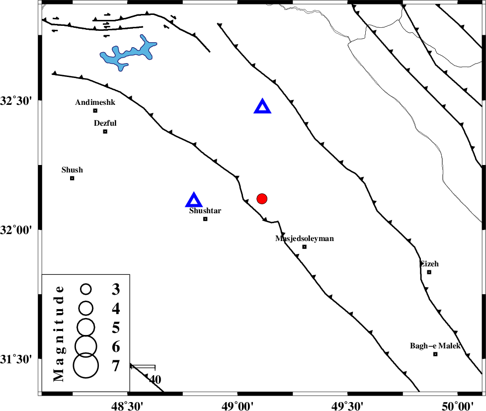
| Location | Lat:32.12 Lon: 49.11 |
| Region | 25 km East of Shushtar, Khoozestan Province |
Nearest Cities |
|
| 4 km of Haft shahidan, Khoozestan Province | |
| 17 km South of Jaefarabad, Khoozestan Province | |
| 26 km North East of Shushtar, Khoozestan Province | |
| 26 km East of Samaleh, Khoozestan Province | |
| 28 km North West of Masjed Soleyman, Khoozestan Province | |
| Depth | 14 km |
| Agency | |
Faults within 150 km: |
|
| DEZFUL_EMBAYMENT (Length: 228 km) , Distance to epicenter: 6 km | |
| MFF2 (Length: 205 km) , Distance to epicenter: 34 km | |
| BALARUD_F_Z2 (Length: 58 km) , Distance to epicenter: 67 km | |
| Number of Phases | 5 |
| RMS | 0 |
| Number of Stations | 4 |
| Error in Latitude | >2 km |
| Error in Longitude | 2.5 km |
| Error in Depth | 3.2 km |
Download waveform in seisan format
to download seisan software Click here
to access information about IIEES stations Click here
Amplitude | ||||||||
| UID | Agency | Station | Component | Amplitude | Period | Arrival Time | Proccessing Time | Signal Clip |
| 39545 | IIEES | ASAO | N | 65 | 0.5 | 2007-08-27 07:57:34 | 2007-11-04 01:43:00 | n |
| 39546 | IIEES | NASN | N | 19.3 | 0.35 | 2007-08-27 07:58:04 | 2007-11-04 01:43:00 | n |
| 39547 | IIEES | SNGE | N | 27.6 | 0.51 | 2007-08-27 07:57:58 | 2007-11-04 01:43:00 | n |
Phase | ||||||||||||
| Agency | Station | Component | Phase Type | Phase Quality | First Motion | Observed Arrival Time | Time Residual | Loc. Flag | Input Weight | Distance | Azimuth | |
| IIEES | SHGR | Z | Pg | E | 2007-08-27 07:56:14 | 0 | y | 28.7 | 268 | |||
| IIEES | ASAO | Z | Pn | E | 2007-08-27 07:56:52 | 0 | y | 283 | 17 | |||
| IIEES | ASAO | N | Sg | E | 2007-08-27 07:57:29 | 0 | y | 283 | 17 | |||
| IIEES | NASN | Z | Pn | E | 2007-08-27 07:57:01 | 0 | y | 356 | 77 | |||
| IIEES | SNGE | Z | Pn | E | 2007-08-27 07:57:02 | 0 | y | 368 | 334 | |||