
Magnitude |
:4.5 |
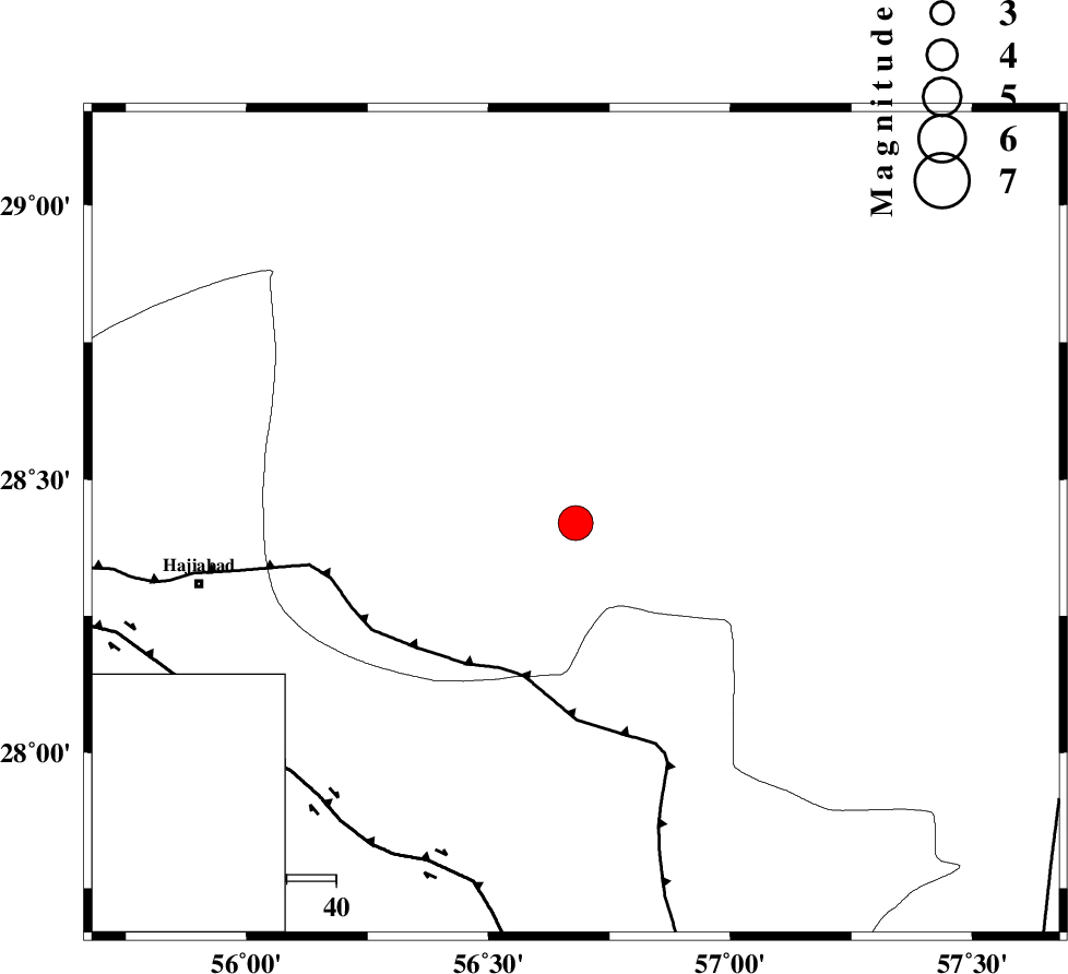
| Date & Time (UTC) | 2007-08-25 04:24:22.8 |
| Date & Time (Local) | 1386/6/3 07:54:22.8 |
| Location | Lat:28.42 Lon: 56.68 |
| Region | 77 km North-East of Hajiabad, Hormozgan Province |
Nearest Cities |
|
| 21 km North West of Sarkhan, Kerman Province | |
| 29 km East of Shahmaran, Kerman Province | |
| 31 km East of Arzuieeh, Kerman Province | |
| 51 km South West of Dolatabad, Kerman Province | |
| 60 km South of Kashkueyeh, Kerman Province | |
| Depth | 14 km |
| Agency | |
Faults within 150 km: |
|
| MAIN_ZAGROS_R_F (Length: 1106 km) , Distance to epicenter: 33 km | |
| HZF2 (Length: 437 km) , Distance to epicenter: 75 km | |
| ZENDAN_MINAB_F_Z1 (Length: 183 km) , Distance to epicenter: 90 km | |
| Number of Phases | 6 |
| RMS | 0.2 |
| Number of Stations | 6 |
| Error in Latitude | >8.2 km |
| Error in Longitude | 3.2 km |
| Error in Depth | 11.2 km |
Download waveform in seisan format
to download seisan software Click here
to access information about IIEES stations Click here
Amplitude | ||||||||
| UID | Agency | Station | Component | Amplitude | Period | Arrival Time | Proccessing Time | Signal Clip |
| 39471 | IIEES | KRBR | E | 6499.7 | 0.49 | 2007-08-25 04:25:29 | 2007-11-04 01:43:00 | n |
| 39472 | IIEES | KRBR | N | 4659.7 | 0.49 | 2007-08-25 04:25:38 | 2007-11-04 01:43:00 | n |
| 39473 | IIEES | GHIR | N | 1137.6 | 0.52 | 2007-08-25 04:26:39 | 2007-11-04 01:43:00 | n |
| 39474 | IIEES | GHIR | E | 1374.3 | 0.65 | 2007-08-25 04:26:44 | 2007-11-04 01:43:00 | n |
Phase | ||||||||||||
| Agency | Station | Component | Phase Type | Phase Quality | First Motion | Observed Arrival Time | Time Residual | Loc. Flag | Input Weight | Distance | Azimuth | |
| IIEES | KRBR | Z | Pg | E | 2007-08-25 04:24:51 | -0.1 | y | 173 | 2 | |||
| IIEES | GHIR | Z | Pn | E | 2007-08-25 04:25:15 | -0.1 | y | 363 | 269 | |||
| IIEES | ZHSF | Z | Pn | E | 2007-08-25 04:25:22 | 0 | y | 420 | 71 | |||
| IIEES | SHGR | Z | Pn | E | 2007-08-25 04:26:17 | 0.1 | y | 861 | 300 | |||
| IIEES | DAMV | Z | Pn | E | 2007-08-25 04:26:24 | 0.4 | y | 915 | 332 | |||
| IIEES | SNGE | Z | Pn | E | 2007-08-25 04:26:53 | -0.2 | y | 1152 | 312 | |||