
Magnitude |
:2.5 |
| Date & Time (UTC) | 2007-07-04 09:25:54.9 |
| Date & Time (Local) | 1386/4/13 12:55:54.9 |
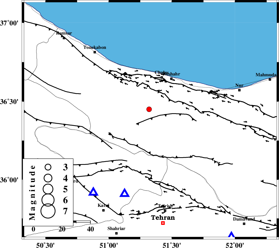
| Location | Lat:36.38 Lon: 51.33 |
| Region | 31 km South of Chalus, Mazandaran Province |
Nearest Cities |
|
| 6 km of Tavir, Mazandaran Province | |
| 9 km of Marzanabad, Mazandaran Province | |
| 14 km South of Goyter, Mazandaran Province | |
| 18 km North of Pol-e zanguleh, Mazandaran Province | |
| 18 km South East of Kardichal, Mazandaran Province | |
| Depth | 15 km |
| Agency | |
Faults within 150 km: |
|
| KOJOOR (Length: 75 km) , Distance to epicenter: 8 km | |
| N_ALBORZ_F (Length: 360 km) , Distance to epicenter: 21 km | |
| KANDOVAN_F (Length: 90 km) , Distance to epicenter: 21 km | |
| Number of Phases | 5 |
| RMS | 0 |
| Number of Stations | 3 |
| Error in Latitude | >3.1 km |
| Error in Longitude | 1.6 km |
| Error in Depth | 4.4 km |
Download waveform in seisan format
to download seisan software Click here
to access information about IIEES stations Click here
Amplitude | ||||||||
| UID | Agency | Station | Component | Amplitude | Period | Arrival Time | Proccessing Time | Signal Clip |
| 38862 | IIEES | THKV | N | 256.9 | 0.33 | 2007-07-04 09:26:16 | 2007-11-04 01:43:00 | n |
| 38863 | IIEES | ASAO | N | 37.6 | 0.46 | 2007-07-04 09:27:03 | 2007-11-04 01:43:00 | n |
Phase | ||||||||||||
| Agency | Station | Component | Phase Type | Phase Quality | First Motion | Observed Arrival Time | Time Residual | Loc. Flag | Input Weight | Distance | Azimuth | |
| IIEES | THKV | Z | Pg | E | 2007-07-04 09:26:06 | 0 | y | 65.5 | 219 | |||
| IIEES | DAMV | Z | Pg | E | 2007-07-04 09:26:12 | 0.1 | y | 101 | 145 | |||
| IIEES | DAMV | N | Sg | E | 2007-07-04 09:26:24 | 0 | y | 101 | 145 | |||
| IIEES | ASAO | Z | Pn | E | 2007-07-04 09:26:31 | 0 | y | 235 | 211 | |||
| IIEES | ASAO | E | Sg | E | 2007-07-04 09:27:01 | 0 | y | 235 | 211 | |||