
Magnitude |
:3.6 |
| Date & Time (UTC) | 2007-04-28 21:09:00.8 |
| Date & Time (Local) | 1386/2/9 00:39:00.8 |
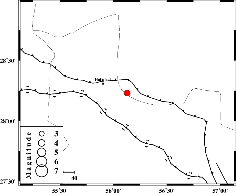
| Location | Lat:28.23 Lon: 56.13 |
| Region | 24 km East of Hajiabad, Hormozgan Province |
Nearest Cities |
|
| 24 km East of Hajiabad, Hormozgan Province | |
| 26 km North West of Fareqan, Hormozgan Province | |
| 32 km South West of Arzuieeh, Kerman Province | |
| 35 km South West of Shahmaran, Kerman Province | |
| 70 km North East of Fin, Hormozgan Province | |
| Depth | 14 km |
| Agency | |
Faults within 150 km: |
|
| MAIN_ZAGROS_R_F (Length: 1106 km) , Distance to epicenter: 9 km | |
| HZF2 (Length: 437 km) , Distance to epicenter: 28 km | |
| HZF1 (Length: 102 km) , Distance to epicenter: 101 km | |
| Number of Phases | 4 |
| RMS | 0.3 |
| Number of Stations | 4 |
| Error in Latitude | >3.3 km |
| Error in Longitude | 8 km |
| Error in Depth | 8.9 km |
Download waveform in seisan format
to download seisan software Click here
to access information about IIEES stations Click here
Amplitude | ||||||||
| UID | Agency | Station | Component | Amplitude | Period | Arrival Time | Proccessing Time | Signal Clip |
| 38701 | IIEES | BNDS | N | 1998.3 | 0.57 | 2007-04-28 21:09:39 | 2007-07-30 02:44:00 | n |
| 38702 | IIEES | KRBR | N | 625.3 | 0.91 | 2007-04-28 21:10:12 | 2007-07-30 02:44:00 | n |
Phase | ||||||||||||
| Agency | Station | Component | Phase Type | Phase Quality | First Motion | Observed Arrival Time | Time Residual | Loc. Flag | Input Weight | Distance | Azimuth | |
| IIEES | BNDS | Z | Pg | E | 2007-04-28 21:09:16 | -0.1 | y | 92 | 178 | |||
| IIEES | KRBR | Z | Pg | E | 2007-04-28 21:09:34 | -0.3 | y | 204 | 17 | |||
| IIEES | ZHSF | Z | Pn | E | 2007-04-28 21:10:08 | 0.3 | y | 478 | 70 | |||
| IIEES | NASN | Z | Pn | E | 2007-04-28 21:10:23 | 0.3 | y | 599 | 329 | |||