
Magnitude |
:3.4 |
| Date & Time (UTC) | 2007-06-23 12:27:50.4 |
| Date & Time (Local) | 1386/4/2 15:57:50.4 |
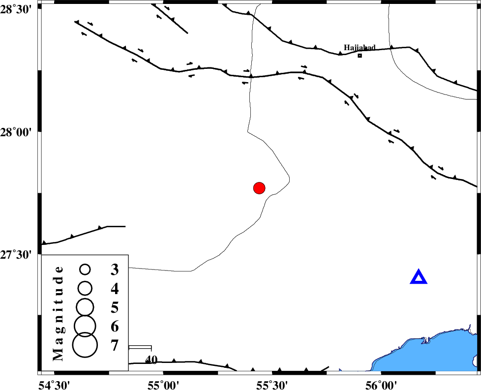
| Location | Lat:27.77 Lon: 55.44 |
| Region | 74 km South-West of Hajiabad, Hormozgan Province |
Nearest Cities |
|
| 10 km of Darz, Fars Province | |
| 48 km North West of Fin, Hormozgan Province | |
| 54 km South East of Fadami, Fars Province | |
| 64 km South East of Doborji, Fars Province | |
| 75 km South West of Hajiabad, Hormozgan Province | |
| Depth | 15 km |
| Agency | |
Faults within 150 km: |
|
| HZF2 (Length: 437 km) , Distance to epicenter: 50 km | |
| LAR_F (Length: 99 km) , Distance to epicenter: 63 km | |
| MAIN_ZAGROS_R_F (Length: 1106 km) , Distance to epicenter: 67 km | |
| Number of Phases | 3 |
| RMS | 0 |
| Number of Stations | 3 |
| Error in Latitude | >2.4 km |
| Error in Longitude | 1.7 km |
| Error in Depth | 0 km |
Download waveform in seisan format
to download seisan software Click here
to access information about IIEES stations Click here
Amplitude | ||||||||
| UID | Agency | Station | Component | Amplitude | Period | Arrival Time | Proccessing Time | Signal Clip |
| 38504 | IIEES | BNDS | N | 1635.5 | 0.29 | 2007-06-23 12:28:20 | 2007-07-30 02:44:00 | n |
| 38505 | IIEES | GHIR | N | 240.1 | 0.32 | 2007-06-23 12:29:14 | 2007-07-30 02:44:00 | n |
| 38506 | IIEES | KRBR | N | 122.2 | 0.52 | 2007-06-23 12:29:09 | 2007-07-30 02:44:00 | n |
Phase | ||||||||||||
| Agency | Station | Component | Phase Type | Phase Quality | First Motion | Observed Arrival Time | Time Residual | Loc. Flag | Input Weight | Distance | Azimuth | |
| IIEES | BNDS | Z | Pg | E | 2007-06-23 12:28:04 | 0 | y | 82.9 | 120 | |||
| IIEES | GHIR | Z | Pg | E | 2007-06-23 12:28:30 | 0 | y | 248 | 284 | |||
| IIEES | KRBR | Z | Pn | E | 2007-06-23 12:28:32 | 0 | y | 277 | 27 | |||