
Magnitude |
:2.9 |
| Date & Time (UTC) | 2007-04-09 14:23:52.2 |
| Date & Time (Local) | 1386/1/20 17:53:52.2 |
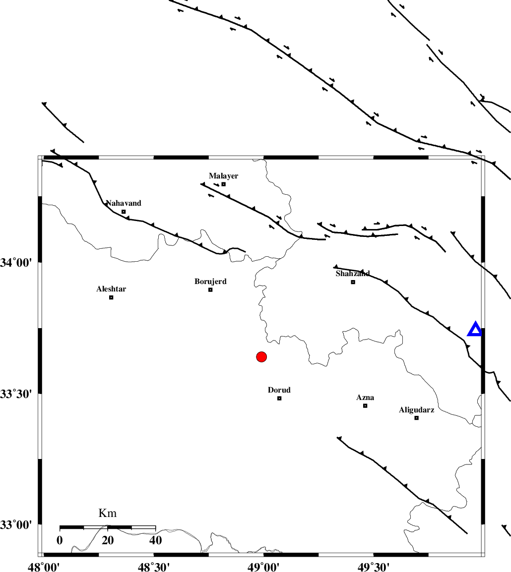
| Location | Lat:33.64 Lon: 48.99 |
| Region | 19 km North of Dorud, Lorestan Province |
Nearest Cities |
|
| 5 km North of Kagheh, Lorestan Province | |
| 10 km East of Chalanchulan, Lorestan Province | |
| 13 km North of Void, Lorestan Province | |
| 14 km North East of Razan, Lorestan Province | |
| 17 km North West of Zhan, Lorestan Province | |
| Depth | 15 km |
| Agency | |
Faults within 150 km: |
|
| DORUD (Length: 100 km) , Distance to epicenter: 5 km | |
| MAIN_ZAGROS_R_F (Length: 1106 km) , Distance to epicenter: 18 km | |
| NAHAVAND_F (Length: 102 km) , Distance to epicenter: 29 km | |
| Number of Phases | 6 |
| RMS | 0.2 |
| Number of Stations | 5 |
| Error in Latitude | >3.2 km |
| Error in Longitude | 4.2 km |
| Error in Depth | 10.2 km |
Download waveform in seisan format
to download seisan software Click here
to access information about IIEES stations Click here
Amplitude | ||||||||
| UID | Agency | Station | Component | Amplitude | Period | Arrival Time | Proccessing Time | Signal Clip |
| 38028 | IIEES | ASAO | N | 110.8 | 0.72 | 2007-04-09 14:24:37 | 2007-07-30 02:44:00 | n |
| 38029 | IIEES | SHGR | N | 163.3 | 0.68 | 2007-04-09 14:24:47 | 2007-07-30 02:44:00 | n |
| 38030 | IIEES | SHGR | E | 260.9 | 0.52 | 2007-04-09 14:24:47 | 2007-07-30 02:44:00 | n |
Phase | ||||||||||||
| Agency | Station | Component | Phase Type | Phase Quality | First Motion | Observed Arrival Time | Time Residual | Loc. Flag | Input Weight | Distance | Azimuth | |
| IIEES | ASAO | Z | Pg | E | 2007-04-09 14:24:15 | -0.3 | y | 138 | 43 | |||
| IIEES | ASAO | E | Sg | E | 2007-04-09 14:24:32 | -0.1 | y | 138 | 43 | |||
| IIEES | SHGR | Z | Pg | E | 2007-04-09 14:24:20 | -0.1 | y | 171 | 186 | |||
| IIEES | SNGE | Z | Pg | E | 2007-04-09 14:24:28 | 0.1 | y | 221 | 317 | |||
| IIEES | GHVR | Z | Pg | E | 2007-04-09 14:24:29 | 0.4 | y | 228 | 65 | |||
| IIEES | NASN | Z | Pn | E | 2007-04-09 14:24:45 | 0 | y | 368 | 104 | |||