
Magnitude |
:3.1 |
| Date & Time (UTC) | 2007-01-16 02:39:29.3 |
| Date & Time (Local) | 1385/10/26 06:09:29.3 |
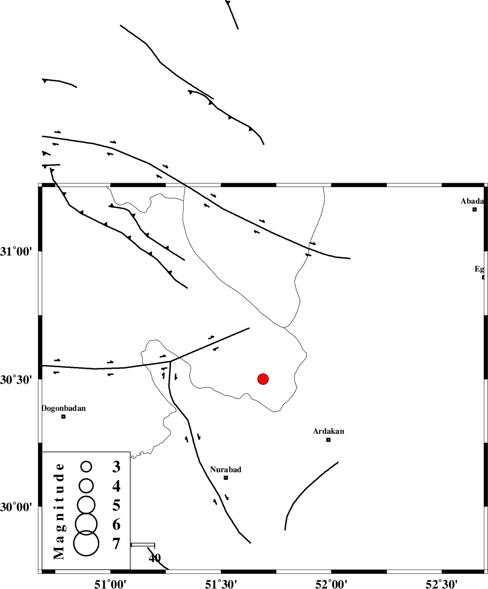
| Location | Lat:30.5 Lon: 51.69 |
| Region | 22 km South-East of Yasuj, Kohkiluieh va boyerahmad Province |
Nearest Cities |
|
| 16 km South East of Tal-e khosro, Kohkiluieh va boyerahmad Province | |
| 18 km East of Hoseynabad, Kohkiluieh va boyerahmad Province | |
| 19 km North West of Kamhar, Fars Province | |
| 22 km South East of Yasuj, Kohkiluieh va boyerahmad Province | |
| 32 km North East of Chehar taq, Fars Province | |
| Depth | 18 km |
| Agency | |
Faults within 150 km: |
|
| KAZERUN_F (Length: 96 km) , Distance to epicenter: 13 km | |
| HZF3 (Length: 197 km) , Distance to epicenter: 17 km | |
| DENA_F (Length: 137 km) , Distance to epicenter: 30 km | |
| Number of Phases | 5 |
| RMS | 0.1 |
| Number of Stations | 4 |
| Error in Latitude | >2.2 km |
| Error in Longitude | 4.8 km |
| Error in Depth | 7.6 km |
Download waveform in seisan format
to download seisan software Click here
to access information about IIEES stations Click here
Amplitude | ||||||||
| UID | Agency | Station | Component | Amplitude | Period | Arrival Time | Proccessing Time | Signal Clip |
| 37303 | IIEES | GHIR | N | 107.3 | 0.64 | 2007-01-16 02:41:08 | 2007-05-09 05:26:00 | n |
| 37304 | IIEES | GHIR | E | 90.7 | 0.56 | 2007-01-16 02:41:10 | 2007-05-09 05:26:00 | n |
| 37305 | IIEES | ASAO | N | 17.5 | 0.64 | 2007-01-16 02:41:31 | 2007-05-09 05:26:00 | n |
| 37306 | IIEES | KRBR | N | 13.3 | 0.76 | 2007-01-16 02:42:01 | 2007-05-09 05:26:00 | n |
| 37307 | IIEES | KRBR | E | 20.7 | 0.76 | 2007-01-16 02:42:02 | 2007-05-09 05:26:00 | n |
Phase | ||||||||||||
| Agency | Station | Component | Phase Type | Phase Quality | First Motion | Observed Arrival Time | Time Residual | Loc. Flag | Input Weight | Distance | Azimuth | |
| IIEES | NASN | E | Sg | E | 2007-01-16 02:40:47 | 0 | y | 276 | 22 | |||
| IIEES | GHIR | Z | Pn | E | 2007-01-16 02:40:11 | 0.1 | y | 276 | 153 | |||
| IIEES | NASN | Z | Pn | E | 2007-01-16 02:40:11 | 0 | y | 276 | 22 | |||
| IIEES | ASAO | Z | Pn | E | 2007-01-16 02:40:35 | 0 | y | 475 | 341 | |||
| IIEES | KRBR | Z | Pn | E | 2007-01-16 02:40:37 | -0.1 | y | 491 | 95 | |||