
Magnitude |
:2.5 |
| Date & Time (UTC) | 2007-01-02 08:29:13.0 |
| Date & Time (Local) | 1385/10/12 11:59:13.0 |
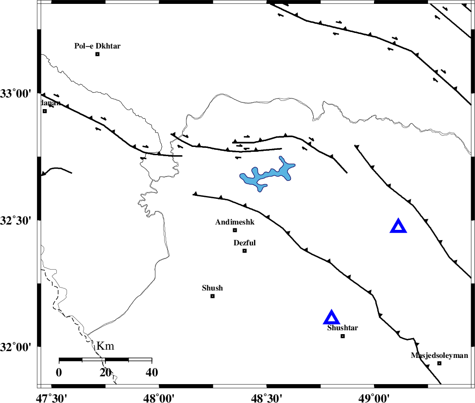
| Location | Lat:32.6 Lon: 48.45 |
| Region | 17 km North of Andimeshk, Khoozestan Province |
Nearest Cities |
|
| 18 km North of Andimeshk, Khoozestan Province | |
| 21 km East of Hoseinieh, Khoozestan Province | |
| 22 km South East of Sorkhakan, Khoozestan Province | |
| 25 km North of Dezful, Khoozestan Province | |
| 26 km South East of Bidruyeh, Khoozestan Province | |
| Depth | 18 km |
| Agency | |
Faults within 150 km: |
|
| DEZFUL_EMBAYMENT (Length: 228 km) , Distance to epicenter: 8 km | |
| BALARUD_F_Z3 (Length: 53 km) , Distance to epicenter: 19 km | |
| BALARUD_F_Z2 (Length: 58 km) , Distance to epicenter: 23 km | |
| Number of Phases | 5 |
| RMS | 0.1 |
| Number of Stations | 4 |
| Error in Latitude | >3.8 km |
| Error in Longitude | 7.4 km |
| Error in Depth | 5.9 km |
Download waveform in seisan format
to download seisan software Click here
to access information about IIEES stations Click here
Amplitude | ||||||||
| UID | Agency | Station | Component | Amplitude | Period | Arrival Time | Proccessing Time | Signal Clip |
| 37200 | IIEES | SHGR | E | 269.2 | 0.35 | 2007-01-02 08:29:46 | 2007-05-09 05:26:00 | n |
| 37201 | IIEES | SHGR | N | 164.1 | 0.47 | 2007-01-02 08:29:48 | 2007-05-09 05:26:00 | n |
| 37202 | IIEES | ASAO | E | 27.1 | 0.79 | 2007-01-02 08:30:31 | 2007-05-09 05:26:00 | n |
| 37203 | IIEES | ASAO | N | 26.6 | 0.84 | 2007-01-02 08:30:33 | 2007-05-09 05:26:00 | n |
| 37204 | IIEES | SNGE | N | 19.8 | 0.6 | 2007-01-02 08:30:39 | 2007-05-09 05:26:00 | n |
Phase | ||||||||||||
| Agency | Station | Component | Phase Type | Phase Quality | First Motion | Observed Arrival Time | Time Residual | Loc. Flag | Input Weight | Distance | Azimuth | |
| IIEES | SHGR | Z | Pg | E | 2007-01-02 08:29:24 | 0 | y | 63.4 | 149 | |||
| IIEES | ASAO | Z | Pn | E | 2007-01-02 08:29:53 | 0.2 | y | 261 | 34 | |||
| IIEES | SNGE | Z | Pn | E | 2007-01-02 08:29:57 | 0 | y | 295 | 340 | |||
| IIEES | SNGE | N | Sg | E | 2007-01-02 08:30:36 | 0 | y | 295 | 340 | |||
| IIEES | NASN | Z | Pn | E | 2007-01-02 08:30:11 | -0.2 | y | 409 | 86 | |||