
Magnitude |
:2.6 |
| Date & Time (UTC) | 2006-08-20 07:30:24.7 |
| Date & Time (Local) | 1385/5/29 11:00:24.7 |
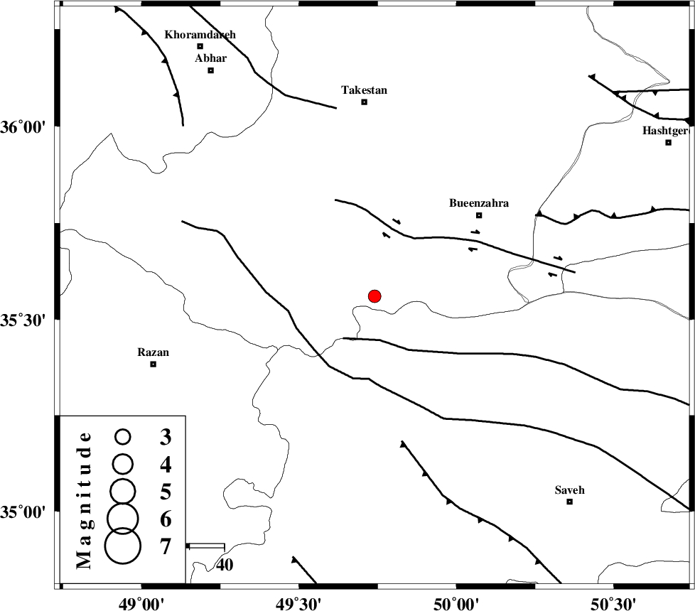
| Location | Lat:35.56 Lon: 49.74 |
| Region | 38 km South-West of Buinzara, Ghazvin Province |
Nearest Cities |
|
| 19 km North of Duzaj, Markazi Province | |
| 25 km South of Danesfahan, Ghazvin Province | |
| 25 km East of Kolanjin, Ghazvin Province | |
| 29 km South West of Sagezabad, Ghazvin Province | |
| 32 km North West of Razegian, Markazi Province | |
| Depth | 46 km |
| Agency | |
Faults within 150 km: |
|
| S_PARANDAK_F (Length: 116 km) , Distance to epicenter: 13 km | |
| IPAK_F (Length: 80 km) , Distance to epicenter: 20 km | |
| KUSHK_E_NOSRAT_F (Length: 230 km) , Distance to epicenter: 23 km | |
| Number of Phases | 8 |
| RMS | 0.3 |
| Number of Stations | 5 |
| Error in Latitude | >3.5 km |
| Error in Longitude | 3.2 km |
| Error in Depth | 16.5 km |
Download waveform in seisan format
to download seisan software Click here
to access information about IIEES stations Click here
Amplitude | ||||||||
| UID | Agency | Station | Component | Amplitude | Period | Arrival Time | Proccessing Time | Signal Clip |
| 35866 | IIEES | CHTH | N | 141.1 | 0.16 | 2006-08-20 07:31:04 | 2006-10-17 03:59:00 | n |
| 35867 | IIEES | CHTH | E | 92.4 | 0.08 | 2006-08-20 07:31:04 | 2006-10-17 03:59:00 | n |
| 35868 | IIEES | DAMV | N | 61 | 0.21 | 2006-08-20 07:31:28 | 2006-10-17 03:59:00 | n |
| 35869 | IIEES | SNGE | N | 40.5 | 0.52 | 2006-08-20 07:31:28 | 2006-10-17 03:59:00 | n |
Phase | ||||||||||||
| Agency | Station | Component | Phase Type | Phase Quality | First Motion | Observed Arrival Time | Time Residual | Loc. Flag | Input Weight | Distance | Azimuth | |
| IIEES | THKV | Z | PG | E | 2006-08-20 07:30:43 | -0.3 | y | 110 | 69 | |||
| IIEES | THKV | N | Sg | E | 2006-08-20 07:30:58 | 0.4 | y | 110 | 69 | |||
| IIEES | ASAO | Z | PG | E | 2006-08-20 07:30:44 | 0 | y | 115 | 167 | |||
| IIEES | ASAO | E | SG | E | 2006-08-20 07:30:59 | 0 | y | 115 | 167 | |||
| IIEES | CHTH | Z | PG | E | 2006-08-20 07:30:46 | -0.4 | y | 131 | 72 | |||
| IIEES | DAMV | Z | PG | E | 2006-08-20 07:30:58 | 0.3 | y | 202 | 87 | |||
| IIEES | SNGE | Z | PG | E | 2006-08-20 07:31:01 | 0 | y | 224 | 257 | |||
| IIEES | SNGE | N | SG | E | 2006-08-20 07:31:27 | 0.1 | y | 224 | 257 | |||