
Magnitude |
:2.5 |
| Date & Time (UTC) | 2006-08-14 10:45:13.3 |
| Date & Time (Local) | 1385/5/23 14:15:13.3 |
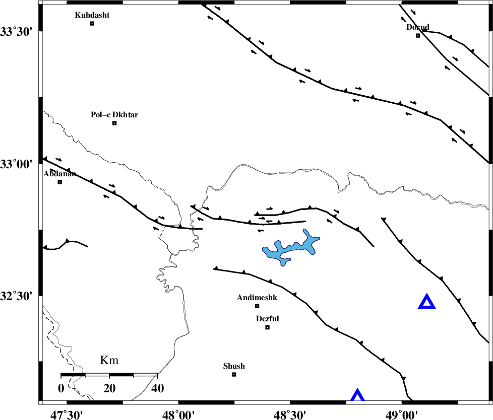
| Location | Lat:32.85 Lon: 48.39 |
| Region | 43 km North of Andimeshk, Khoozestan Province |
Nearest Cities |
|
| 10 km North of Sorkhakan, Khoozestan Province | |
| 18 km North East of Bidruyeh, Khoozestan Province | |
| 23 km North East of Hoseinieh, Khoozestan Province | |
| 40 km North West of Shuy, Khoozestan Province | |
| 44 km North of Andimeshk, Khoozestan Province | |
| Depth | 18 km |
| Agency | |
Faults within 150 km: |
|
| BALARUD_F_Z2 (Length: 58 km) , Distance to epicenter: 7 km | |
| BALARUD_F_Z3 (Length: 53 km) , Distance to epicenter: 9 km | |
| BALARUD_F_Z1 (Length: 87 km) , Distance to epicenter: 29 km | |
| Number of Phases | 5 |
| RMS | 0.1 |
| Number of Stations | 3 |
| Error in Latitude | >2.1 km |
| Error in Longitude | 6 km |
| Error in Depth | 6.9 km |
Download waveform in seisan format
to download seisan software Click here
to access information about IIEES stations Click here
Amplitude | ||||||||
| UID | Agency | Station | Component | Amplitude | Period | Arrival Time | Proccessing Time | Signal Clip |
| 35656 | IIEES | SHGR | E | 131.6 | 0.31 | 2006-08-14 10:45:56 | 2006-10-17 03:59:00 | n |
| 35657 | IIEES | SHGR | N | 140.4 | 0.63 | 2006-08-14 10:45:57 | 2006-10-17 03:59:00 | n |
| 35658 | IIEES | ASAO | E | 33.4 | 0.55 | 2006-08-14 10:46:31 | 2006-10-17 03:59:00 | n |
| 35659 | IIEES | ASAO | N | 22.8 | 0.42 | 2006-08-14 10:46:31 | 2006-10-17 03:59:00 | n |
| 35660 | IIEES | SNGE | N | 45.3 | 0.54 | 2006-08-14 10:46:36 | 2006-10-17 03:59:00 | n |
Phase | ||||||||||||
| Agency | Station | Component | Phase Type | Phase Quality | First Motion | Observed Arrival Time | Time Residual | Loc. Flag | Input Weight | Distance | Azimuth | |
| IIEES | SHGR | Z | PG | E | 2006-08-14 10:45:28 | -0.2 | y | 90.9 | 155 | |||
| IIEES | SHGR | N | SG | E | 2006-08-14 10:45:40 | 0.2 | y | 90.9 | 155 | |||
| IIEES | ASAO | Z | PG | E | 2006-08-14 10:45:52 | 0 | y | 242 | 38 | |||
| IIEES | SNGE | Z | PN | E | 2006-08-14 10:45:53 | -0.1 | y | 267 | 339 | |||
| IIEES | SNGE | E | SG | E | 2006-08-14 10:46:28 | 0.1 | y | 267 | 339 | |||