
Magnitude |
:2.9 |
| Date & Time (UTC) | 2006-09-10 15:46:28.8 |
| Date & Time (Local) | 1385/6/19 19:16:28.8 |
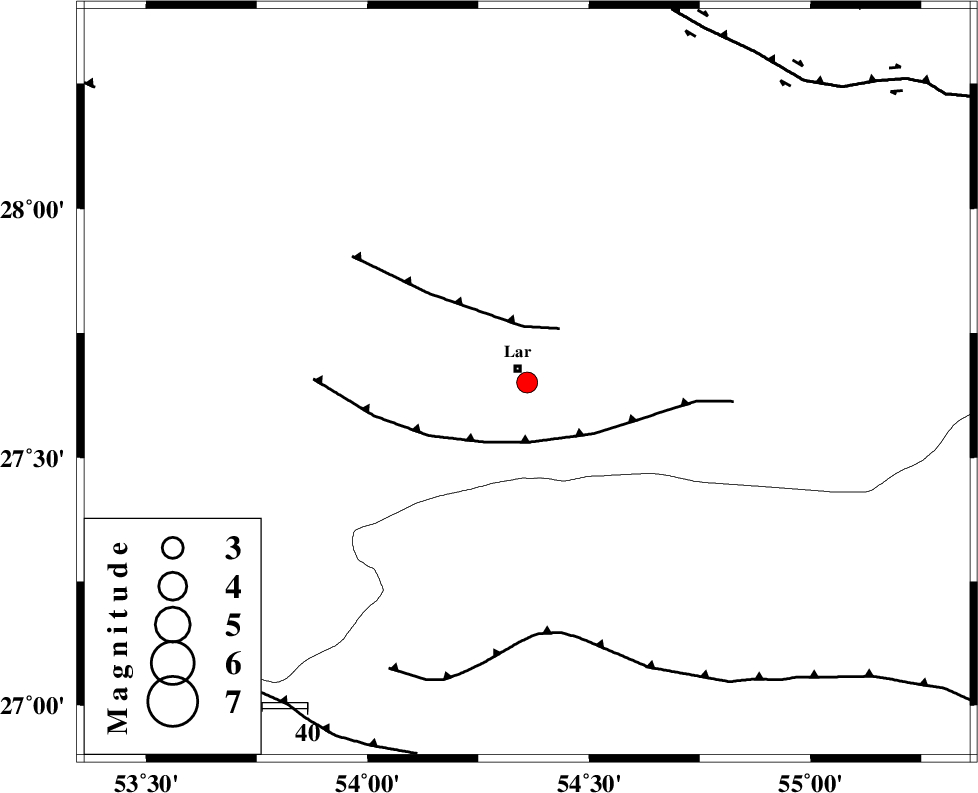
| Location | Lat:27.65 Lon: 54.36 |
| Region | 3 km Lar, Fars Province |
Nearest Cities |
|
| 4 km of Lar, Fars Province | |
| 6 km of Latifi, Fars Province | |
| 19 km East of Grash, Fars Province | |
| 23 km South of Dehkuyeh, Fars Province | |
| 36 km North East of Bagh, Fars Province | |
| Depth | 15 km |
| Agency | |
Faults within 150 km: |
|
| BERIZ_F (Length: 49 km) , Distance to epicenter: 13 km | |
| LAR_F (Length: 99 km) , Distance to epicenter: 13 km | |
| MFF1 (Length: 180 km) , Distance to epicenter: 56 km | |
| Number of Phases | 4 |
| RMS | 0 |
| Number of Stations | 3 |
| Error in Latitude | >4.1 km |
| Error in Longitude | 1.6 km |
| Error in Depth | 0 km |
Download waveform in seisan format
to download seisan software Click here
to access information about IIEES stations Click here
Amplitude | ||||||||
| UID | Agency | Station | Component | Amplitude | Period | Arrival Time | Proccessing Time | Signal Clip |
| 35501 | IIEES | GHIR | E | 250.2 | 0.56 | 2006-09-10 15:47:39 | 2006-10-17 03:59:00 | n |
| 35502 | IIEES | GHIR | N | 115.6 | 0.56 | 2006-09-10 15:47:41 | 2006-10-17 03:59:00 | n |
| 35503 | IIEES | BNDS | N | 81.3 | 0.64 | 2006-09-10 15:47:47 | 2006-10-17 03:59:00 | n |
| 35504 | IIEES | BNDS | E | 101.9 | 0.36 | 2006-09-10 15:47:52 | 2006-10-17 03:59:00 | n |
| 35505 | IIEES | KRBR | E | 43.4 | 0.48 | 2006-09-10 15:48:17 | 2006-10-17 03:59:00 | n |
| 35506 | IIEES | KRBR | N | 49.1 | 0.64 | 2006-09-10 15:48:25 | 2006-10-17 03:59:00 | n |
Phase | ||||||||||||
| Agency | Station | Component | Phase Type | Phase Quality | First Motion | Observed Arrival Time | Time Residual | Loc. Flag | Input Weight | Distance | Azimuth | |
| IIEES | GHIR | Z | PG | E | 2006-09-10 15:46:54 | 0 | y | 152 | 298 | |||
| IIEES | GHIR | E | SG | E | 2006-09-10 15:47:12 | 0 | y | 152 | 298 | |||
| IIEES | BNDS | Z | PG | E | 2006-09-10 15:46:58 | 0 | y | 181 | 98 | |||
| IIEES | KRBR | Z | PN | E | 2006-09-10 15:47:20 | 0 | y | 349 | 42 | |||