
Magnitude |
:4.4 |
| Date & Time (UTC) | 2006-06-23 16:14:34.9 |
| Date & Time (Local) | 1385/4/2 19:44:34.9 |
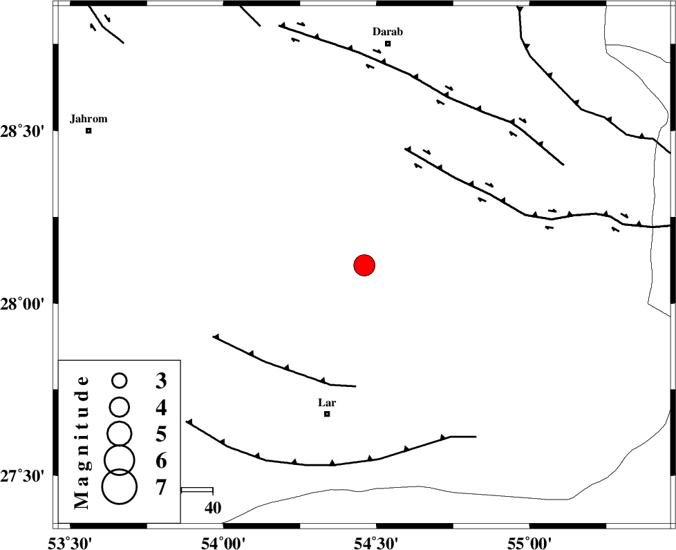
| Location | Lat:28.11 Lon: 54.46 |
| Region | 49 km North-East of Lar, Fars Province |
Nearest Cities |
|
| 25 km South East of Shahr-e pir, Fars Province | |
| 28 km South of Hajiabad, Fars Province | |
| 29 km North of Dehkuyeh, Fars Province | |
| 42 km South East of Dabiran, Fars Province | |
| 46 km North of Latifi, Fars Province | |
| Depth | 15 km |
| Agency | |
Faults within 150 km: |
|
| BERIZ_F (Length: 49 km) , Distance to epicenter: 39 km | |
| HZF2 (Length: 437 km) , Distance to epicenter: 40 km | |
| HZF1 (Length: 102 km) , Distance to epicenter: 60 km | |
| Number of Phases | 7 |
| RMS | 0.3 |
| Number of Stations | 6 |
| Error in Latitude | >4.5 km |
| Error in Longitude | 3 km |
| Error in Depth | 0 km |
Download waveform in seisan format
to download seisan software Click here
to access information about IIEES stations Click here
Amplitude | ||||||||
| UID | Agency | Station | Component | Amplitude | Period | Arrival Time | Proccessing Time | Signal Clip |
| 35061 | IIEES | GHIR | N | 6388 | 0.44 | 2006-06-23 16:15:21 | 2008-03-02 12:02:00 | n |
| 35062 | IIEES | GHIR | E | 11003.3 | 0.6 | 2006-06-23 16:15:24 | 2008-03-02 12:02:00 | n |
| 35063 | IIEES | NASN | E | 191.6 | 0.56 | 2006-06-23 16:16:51 | 2008-03-02 12:02:00 | n |
Phase | ||||||||||||
| Agency | Station | Component | Phase Type | Phase Quality | First Motion | Observed Arrival Time | Time Residual | Loc. Flag | Input Weight | Distance | Azimuth | |
| IIEES | GHIR | Z | PG | E | 2006-06-23 16:14:59 | 0.1 | y | 146 | 278 | |||
| IIEES | BNDS | Z | PG | E | 2006-06-23 16:15:05 | -0.2 | y | 186 | 115 | |||
| IIEES | BNDS | E | SG | E | 2006-06-23 16:15:28 | 0.2 | y | 186 | 115 | |||
| IIEES | NASN | Z | PN | E | 2006-06-23 16:15:50 | 0.4 | y | 544 | 343 | |||
| IIEES | ZHSF | Z | PN | E | 2006-06-23 16:16:01 | -0.1 | y | 638 | 73 | |||
| IIEES | ASAO | Z | Pn | E | 2006-06-23 16:16:25 | -0.6 | y | 829 | 331 | |||
| IIEES | DAMV | Z | PN | E | 2006-06-23 16:16:30 | 0 | y | 867 | 345 | |||