
Magnitude |
:2.8 |
| Date & Time (UTC) | 2006-05-29 21:20:53.0 |
| Date & Time (Local) | 1385/3/9 00:50:53.0 |
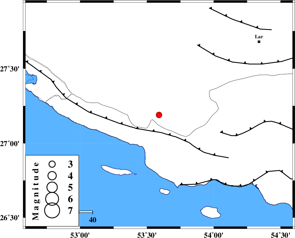
| Location | Lat:27.19 Lon: 53.59 |
| Region | 44 km South-East of Lamerd, Fars Province |
Nearest Cities |
|
| 4 km of Ashkenan, Fars Province | |
| 15 km North West of Ahl, Fars Province | |
| 27 km South of Beyram, Fars Province | |
| 45 km South of Fedagh, Fars Province | |
| 45 km South East of Lamerd, Fars Province | |
| Depth | 33 km |
| Agency | |
Faults within 150 km: |
|
| MFF3 (Length: 292 km) , Distance to epicenter: 13 km | |
| MFF1 (Length: 180 km) , Distance to epicenter: 47 km | |
| ZFF1 (Length: 165 km) , Distance to epicenter: 54 km | |
| Number of Phases | 6 |
| RMS | 0.1 |
| Number of Stations | 4 |
| Error in Latitude | >7.8 km |
| Error in Longitude | 4.6 km |
| Error in Depth | 5 km |
Download waveform in seisan format
to download seisan software Click here
to access information about IIEES stations Click here
Amplitude | ||||||||
| UID | Agency | Station | Component | Amplitude | Period | Arrival Time | Proccessing Time | Signal Clip |
| 34669 | IIEES | GHIR | E | 272.4 | 0.44 | 2006-05-29 21:21:36 | 2008-03-02 12:02:00 | n |
| 34670 | IIEES | GHIR | N | 171.8 | 0.52 | 2006-05-29 21:21:43 | 2008-03-02 12:02:00 | n |
| 34671 | IIEES | BNDS | N | 53.3 | 0.48 | 2006-05-29 21:22:18 | 2008-03-02 12:02:00 | n |
| 34672 | IIEES | BNDS | E | 56.4 | 0.52 | 2006-05-29 21:22:21 | 2008-03-02 12:02:00 | n |
| 34673 | IIEES | KRBR | E | 12.2 | 0.48 | 2006-05-29 21:23:07 | 2008-03-02 12:02:00 | n |
| 34674 | IIEES | KRBR | N | 14.8 | 0.56 | 2006-05-29 21:23:08 | 2008-03-02 12:02:00 | n |
Phase | ||||||||||||
| Agency | Station | Component | Phase Type | Phase Quality | First Motion | Observed Arrival Time | Time Residual | Loc. Flag | Input Weight | Distance | Azimuth | |
| IIEES | GHIR | Z | PG | E | 2006-05-29 21:21:15 | 0 | y | 135 | 334 | |||
| IIEES | GHIR | E | SG | E | 2006-05-29 21:21:31 | 0 | y | 135 | 334 | |||
| IIEES | BNDS | Z | PN | E | 2006-05-29 21:21:30 | 0 | y | 257 | 84 | |||
| IIEES | BNDS | E | SG | E | 2006-05-29 21:22:03 | -0.1 | y | 257 | 84 | |||
| IIEES | KRBR | Z | PN | E | 2006-05-29 21:21:53 | 0.2 | y | 438 | 44 | |||
| IIEES | NASN | Z | PN | E | 2006-05-29 21:22:16 | -0.3 | y | 627 | 353 | |||