
Magnitude |
:3 |
| Date & Time (UTC) | 2006-04-21 02:47:43.8 |
| Date & Time (Local) | 1385/2/1 06:17:43.8 |
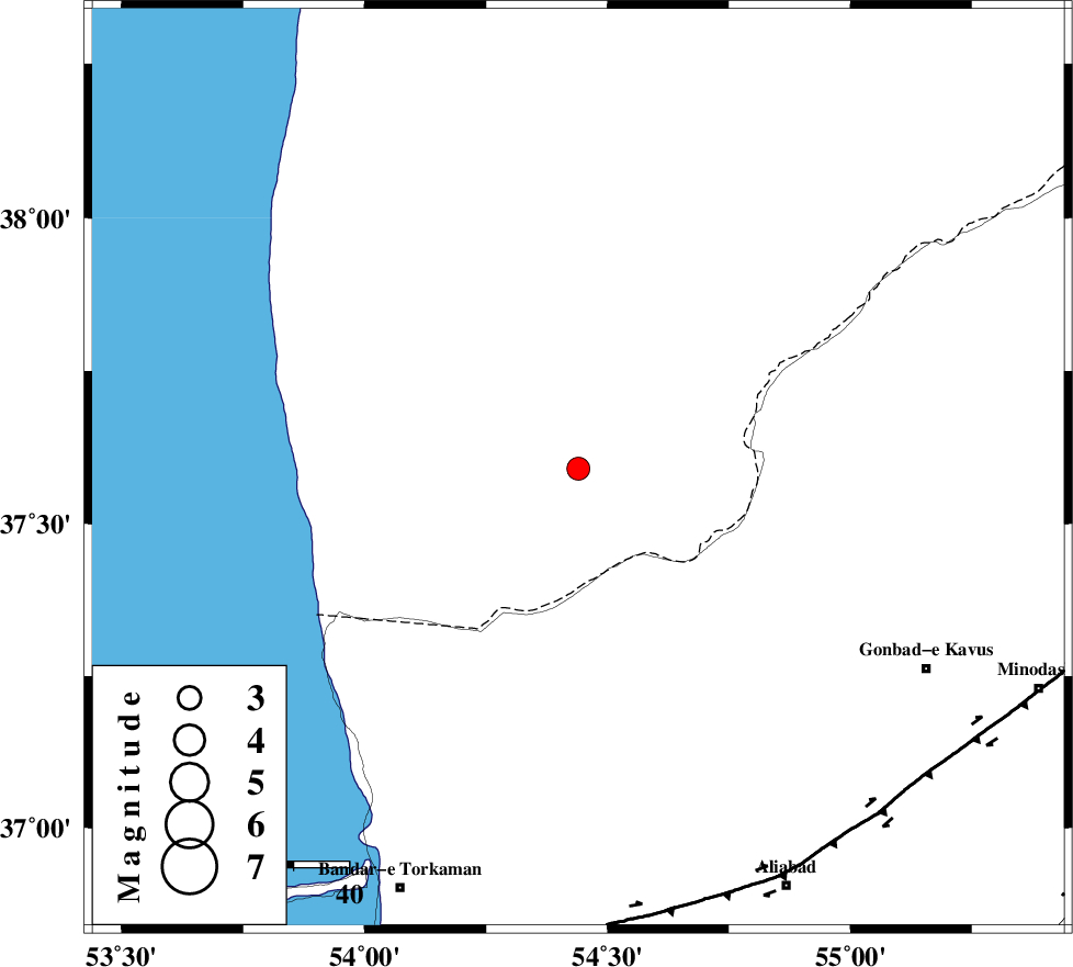
| Location | Lat:37.59 Lon: 54.44 |
| Region | 63 km North of Aq Qaleh, Golestan Province |
Nearest Cities |
|
| 30 km North West of Enchehborun, Golestan Province | |
| 35 km West of Dashliborun, Golestan Province | |
| 62 km North West of Gariduji, Golestan Province | |
| 63 km North East of Gomishtappeh, Golestan Province | |
| 64 km North of Aq Qaleh, Golestan Province | |
| Depth | 46 km |
| Agency | |
Faults within 150 km: |
|
| KHAZAR_F (Length: 523 km) , Distance to epicenter: 80 km | |
| N_ALBORZ_F (Length: 360 km) , Distance to epicenter: 109 km | |
| SHAVAR_F (Length: 87 km) , Distance to epicenter: 112 km | |
| Number of Phases | 7 |
| RMS | 0.2 |
| Number of Stations | 5 |
| Error in Latitude | >6.5 km |
| Error in Longitude | 4.5 km |
| Error in Depth | 5.2 km |
Download waveform in seisan format
to download seisan software Click here
to access information about IIEES stations Click here
Amplitude | ||||||||
| UID | Agency | Station | Component | Amplitude | Period | Arrival Time | Proccessing Time | Signal Clip |
| 34358 | IIEES | DAMV | N | 49.8 | 0.4 | 2006-04-21 02:49:13 | 2008-03-02 12:02:00 | n |
| 34359 | IIEES | DAMV | E | 57.3 | 0.44 | 2006-04-21 02:49:16 | 2008-03-02 12:02:00 | n |
| 34360 | IIEES | THKV | N | 27.4 | 0.56 | 2006-04-21 02:49:28 | 2008-03-02 12:02:00 | n |
| 34361 | IIEES | THKV | E | 36 | 0.52 | 2006-04-21 02:49:32 | 2008-03-02 12:02:00 | n |
Phase | ||||||||||||
| Agency | Station | Component | Phase Type | Phase Quality | First Motion | Observed Arrival Time | Time Residual | Loc. Flag | Input Weight | Distance | Azimuth | |
| IIEES | MRVT | Z | PG | E | 2006-04-21 02:48:08 | 0 | y | 146 | 86 | |||
| IIEES | DAMV | Z | PN | E | 2006-04-21 02:48:26 | -0.3 | y | 309 | 226 | |||
| IIEES | DAMV | N | SG | E | 2006-04-21 02:49:09 | 0 | y | 309 | 226 | |||
| IIEES | THKV | Z | Pn | E | 2006-04-21 02:48:34 | 0.4 | y | 368 | 241 | |||
| IIEES | THKV | E | SG | E | 2006-04-21 02:49:24 | 0 | y | 368 | 241 | |||
| IIEES | ASAO | Z | Pn | E | 2006-04-21 02:48:53 | 0.1 | y | 521 | 231 | |||
| IIEES | GRMI | Z | PN | E | 2006-04-21 02:49:01 | -0.1 | y | 589 | 285 | |||