
Magnitude |
:2.8 |
| Date & Time (UTC) | 2006-06-02 23:04:41.6 |
| Date & Time (Local) | 1385/3/13 02:34:41.6 |
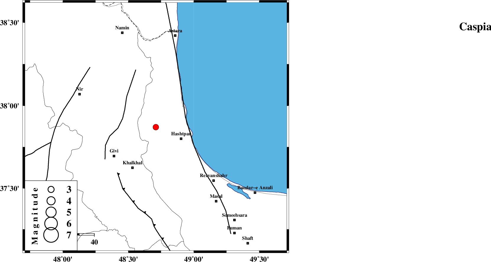
| Location | Lat:37.87 Lon: 48.71 |
| Region | 18 km West of Hashtpar, Gilan Province |
Nearest Cities |
|
| 10 km North of Kish dini, Gilan Province | |
| 18 km North West of Chelonasr, Gilan Province | |
| 19 km North West of Hashtpar, Gilan Province | |
| 20 km North West of Hashtpar, Gilan Province | |
| 23 km South West of Lisar, Gilan Province | |
| Depth | 18 km |
| Agency | |
Faults within 150 km: |
|
| TALESH_F (Length: 258 km) , Distance to epicenter: 21 km | |
| SANGAVAR_F (Length: 61 km) , Distance to epicenter: 23 km | |
| MASULEL_F (Length: 90 km) , Distance to epicenter: 40 km | |
| Number of Phases | 7 |
| RMS | 0.1 |
| Number of Stations | 5 |
| Error in Latitude | >2.8 km |
| Error in Longitude | 4.1 km |
| Error in Depth | 3.7 km |
Download waveform in seisan format
to download seisan software Click here
to access information about IIEES stations Click here
Amplitude | ||||||||
| UID | Agency | Station | Component | Amplitude | Period | Arrival Time | Proccessing Time | Signal Clip |
| 33786 | IIEES | GRMI | E | 272.5 | 0.28 | 2006-06-02 23:05:21 | 2008-03-02 12:02:00 | n |
| 33787 | IIEES | GRMI | N | 165.4 | 0.16 | 2006-06-02 23:05:21 | 2008-03-02 12:02:00 | n |
| 33788 | IIEES | THKV | E | 40 | 0.44 | 2006-06-02 23:06:07 | 2008-03-02 12:02:00 | n |
| 33789 | IIEES | THKV | N | 34.8 | 0.56 | 2006-06-02 23:06:09 | 2008-03-02 12:02:00 | n |
Phase | ||||||||||||
| Agency | Station | Component | Phase Type | Phase Quality | First Motion | Observed Arrival Time | Time Residual | Loc. Flag | Input Weight | Distance | Azimuth | |
| IIEES | GRMI | Z | PG | E | 2006-06-02 23:05:02 | -0.1 | y | 126 | 326 | |||
| IIEES | GRMI | N | SG | E | 2006-06-02 23:05:18 | 0.1 | y | 126 | 326 | |||
| IIEES | THKV | Z | Pn | E | 2006-06-02 23:05:25 | 0 | y | 291 | 138 | |||
| IIEES | THKV | E | SG | E | 2006-06-02 23:06:03 | 0 | y | 291 | 138 | |||
| IIEES | SNGE | Z | Pn | E | 2006-06-02 23:05:30 | 0.1 | y | 332 | 202 | |||
| IIEES | ASAO | Z | PN | E | 2006-06-02 23:05:37 | 0 | y | 387 | 162 | |||
| IIEES | MAKU | Z | PN | E | 2006-06-02 23:05:37 | -0.1 | y | 387 | 296 | |||