
Magnitude |
:3.2 |
| Date & Time (UTC) | 2004-12-24 11:02:26.5 |
| Date & Time (Local) | 1383/10/4 14:32:26.5 |
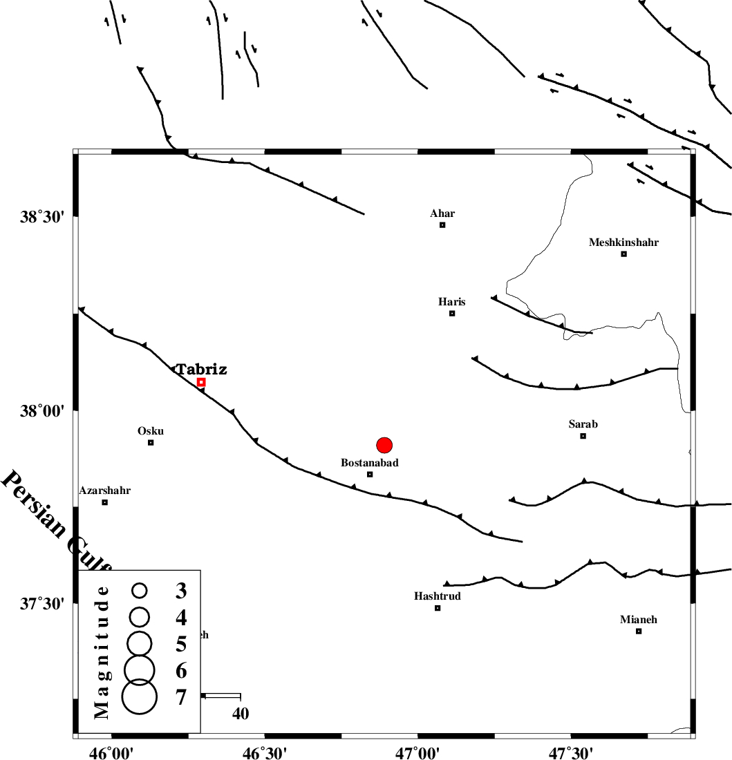
| Location | Lat:37.91 Lon: 46.89 |
| Region | 9 km Bostanabad, Azarbaijan Sharghi Province |
Nearest Cities |
|
| 7 km of Kord kandi, Azarbaijan Sharghi Province | |
| 9 km North of Bostanabad, Azarbaijan Sharghi Province | |
| 14 km North East of Haj aqa, Azarbaijan Sharghi Province | |
| 15 km North of Bonah kahl, Azarbaijan Sharghi Province | |
| 15 km North West of Sarcheshmeh, Azarbaijan Sharghi Province | |
| Depth | 14 km |
| Agency | |
Faults within 150 km: |
|
| N_TABRIZ_F1 (Length: 222 km) , Distance to epicenter: 15 km | |
| BOZQUSH (Length: 70 km) , Distance to epicenter: 35 km | |
| N_TABRIZ_F2 (Length: 52 km) , Distance to epicenter: 89 km | |
| Number of Phases | 5 |
| RMS | 0.2 |
| Number of Stations | 3 |
| Error in Latitude | >8.8 km |
| Error in Longitude | 2.9 km |
| Error in Depth | 24.6 km |
Download waveform in seisan format
to download seisan software Click here
to access information about IIEES stations Click here
Amplitude | ||||||||
| UID | Agency | Station | Component | Amplitude | Period | Arrival Time | Proccessing Time | Signal Clip |
| 31431 | IIEES | GRMI | N | 433.8 | 0.24 | 2004-12-24 11:03:06 | 2006-03-15 11:56:00 | n |
| 31432 | IIEES | GRMI | E | 776.2 | 0.2 | 2004-12-24 11:03:06 | 2006-03-15 11:56:00 | n |
| 31433 | IIEES | MAKU | E | 105.8 | 0.56 | 2004-12-24 11:03:42 | 2006-03-15 11:56:00 | n |
| 31434 | IIEES | MAKU | N | 103.6 | 0.48 | 2004-12-24 11:03:45 | 2006-03-15 11:56:00 | n |
Phase | ||||||||||||
| Agency | Station | Component | Phase Type | Phase Quality | First Motion | Observed Arrival Time | Time Residual | Loc. Flag | Input Weight | Distance | Azimuth | |
| IIEES | GRMI | Z | PG | E | 2004-12-24 11:02:48 | -0.1 | y | 133 | 41 | |||
| IIEES | GRMI | N | SG | E | 2004-12-24 11:03:05 | 0.1 | y | 133 | 41 | |||
| IIEES | MAKU | Z | PG | E | 2004-12-24 11:03:07 | -0.3 | y | 250 | 311 | |||
| IIEES | MAKU | E | SG | E | 2004-12-24 11:03:37 | 0.2 | y | 250 | 311 | |||
| IIEES | ASAO | Z | PN | E | 2004-12-24 11:03:32 | 0.2 | y | 468 | 142 | |||