
Magnitude |
:3 |
| Date & Time (UTC) | 2004-12-21 02:19:30.3 |
| Date & Time (Local) | 1383/10/1 05:49:30.3 |
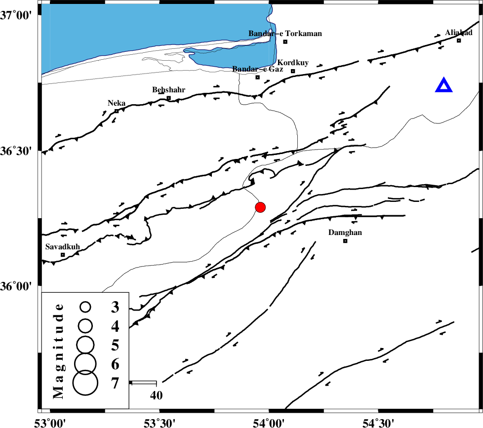
| Location | Lat:36.29 Lon: 53.96 |
| Region | 37 km North-West of Damghan, Semnan Province |
Nearest Cities |
|
| 25 km North East of Talma darreh, Mazandaran Province | |
| 31 km North West of Seydabad, Semnan Province | |
| 32 km North of Darvar, Semnan Province | |
| 32 km South East of Bishehboneh, Mazandaran Province | |
| 34 km North West of Amirabad, Semnan Province | |
| Depth | 14 km |
| Agency | |
Faults within 150 km: |
|
| ASTANEH_F (Length: 72 km) , Distance to epicenter: 7 km | |
| DAMGHAN_F (Length: 95 km) , Distance to epicenter: 14 km | |
| N_ALBORZ_F (Length: 360 km) , Distance to epicenter: 24 km | |
| Number of Phases | 7 |
| RMS | 0.2 |
| Number of Stations | 4 |
| Error in Latitude | >5.7 km |
| Error in Longitude | 5.6 km |
| Error in Depth | 7.4 km |
Download waveform in seisan format
to download seisan software Click here
to access information about IIEES stations Click here
Amplitude | ||||||||
| UID | Agency | Station | Component | Amplitude | Period | Arrival Time | Proccessing Time | Signal Clip |
| 31406 | IIEES | DAMV | N | 174.6 | 0.36 | 2004-12-21 02:20:32 | 2006-03-15 11:56:00 | n |
| 31407 | IIEES | DAMV | E | 344.6 | 0.44 | 2004-12-21 02:20:32 | 2006-03-15 11:56:00 | n |
| 31408 | IIEES | NASN | N | 22.4 | 0.54 | 2004-12-21 02:21:30 | 2006-03-15 11:56:00 | n |
| 31409 | IIEES | ASAO | E | 20 | 0.52 | 2004-12-21 02:21:36 | 2006-03-15 11:56:00 | n |
Phase | ||||||||||||
| Agency | Station | Component | Phase Type | Phase Quality | First Motion | Observed Arrival Time | Time Residual | Loc. Flag | Input Weight | Distance | Azimuth | |
| IIEES | DAMV | Z | PG | E | 2004-12-21 02:20:02 | -0.2 | y | 194 | 248 | |||
| IIEES | DAMV | N | SG | E | 2004-12-21 02:20:25 | 0.1 | y | 194 | 248 | |||
| IIEES | NASN | Z | PN | E | 2004-12-21 02:20:28 | 0.2 | y | 401 | 196 | |||
| IIEES | NASN | Z | PG | E | 2004-12-21 02:20:35 | -0.2 | y | 401 | 196 | |||
| IIEES | ASAO | Z | PN | E | 2004-12-21 02:20:29 | 0.4 | y | 406 | 243 | |||
| IIEES | ASAO | Z | PG | E | 2004-12-21 02:20:35 | -0.1 | y | 406 | 243 | |||
| IIEES | GRMI | Z | PN | E | 2004-12-21 02:20:53 | -0.1 | y | 604 | 299 | |||