
Magnitude |
:3 |
| Date & Time (UTC) | 2004-12-19 21:27:57.7 |
| Date & Time (Local) | 1383/9/30 00:57:57.7 |
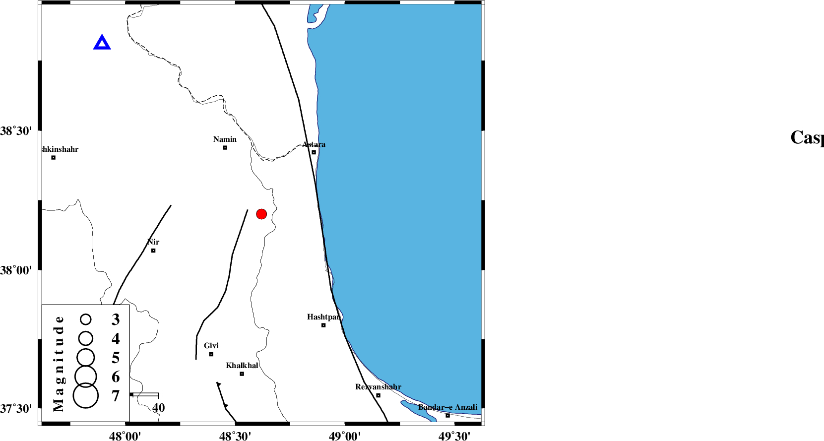
| Location | Lat:38.2 Lon: 48.62 |
| Region | 28 km East of Ardabil, Ardebil Province |
Nearest Cities |
|
| 11 km North of Hir, Ardebil Province | |
| 12 km of Baibiglu, Ardebil Province | |
| 20 km South of Nanehkaran, Ardebil Province | |
| 20 km South of Kiladeh, Gilan Province | |
| 23 km East of Niar, Ardebil Province | |
| Depth | 14 km |
| Agency | |
Faults within 150 km: |
|
| SANGAVAR_F (Length: 61 km) , Distance to epicenter: 6 km | |
| TALESH_F (Length: 258 km) , Distance to epicenter: 25 km | |
| BOZQUSH (Length: 70 km) , Distance to epicenter: 36 km | |
| Number of Phases | 5 |
| RMS | 0.3 |
| Number of Stations | 4 |
| Error in Latitude | >10.4 km |
| Error in Longitude | 16 km |
| Error in Depth | 10 km |
Download waveform in seisan format
to download seisan software Click here
to access information about IIEES stations Click here
Amplitude | ||||||||
| UID | Agency | Station | Component | Amplitude | Period | Arrival Time | Proccessing Time | Signal Clip |
| 31401 | IIEES | MAKU | N | 30.7 | 0.56 | 2004-12-19 21:30:11 | 2006-03-15 11:56:00 | n |
| 31402 | IIEES | DAMV | N | 29.1 | 0.37 | 2004-12-19 21:30:13 | 2006-03-15 11:56:00 | n |
| 31403 | IIEES | DAMV | E | 21.3 | 0.36 | 2004-12-19 21:30:16 | 2006-03-15 11:56:00 | n |
| 31404 | IIEES | ASAO | N | 30.6 | 0.48 | 2004-12-19 21:29:25 | 2006-03-15 11:56:00 | n |
| 31405 | IIEES | ASAO | E | 16.9 | 0.52 | 2004-12-19 21:29:25 | 2006-03-15 11:56:00 | n |
Phase | ||||||||||||
| Agency | Station | Component | Phase Type | Phase Quality | First Motion | Observed Arrival Time | Time Residual | Loc. Flag | Input Weight | Distance | Azimuth | |
| IIEES | GRMI | Z | PG | E | 2004-12-19 21:28:13 | -0.2 | y | 93.2 | 317 | |||
| IIEES | MAKU | Z | PN | E | 2004-12-19 21:28:51 | 0.3 | y | 366 | 292 | |||
| IIEES | DAMV | Z | PN | E | 2004-12-19 21:28:57 | 0.1 | y | 412 | 133 | |||
| IIEES | ASAO | Z | PN | E | 2004-12-19 21:28:58 | 0.3 | y | 424 | 162 | |||
| IIEES | ASAO | Z | PG | E | 2004-12-19 21:29:05 | -0.4 | y | 424 | 162 | |||