
Magnitude |
:3.6 |
| Date & Time (UTC) | 2004-12-13 02:02:32.5 |
| Date & Time (Local) | 1383/9/23 05:32:32.5 |
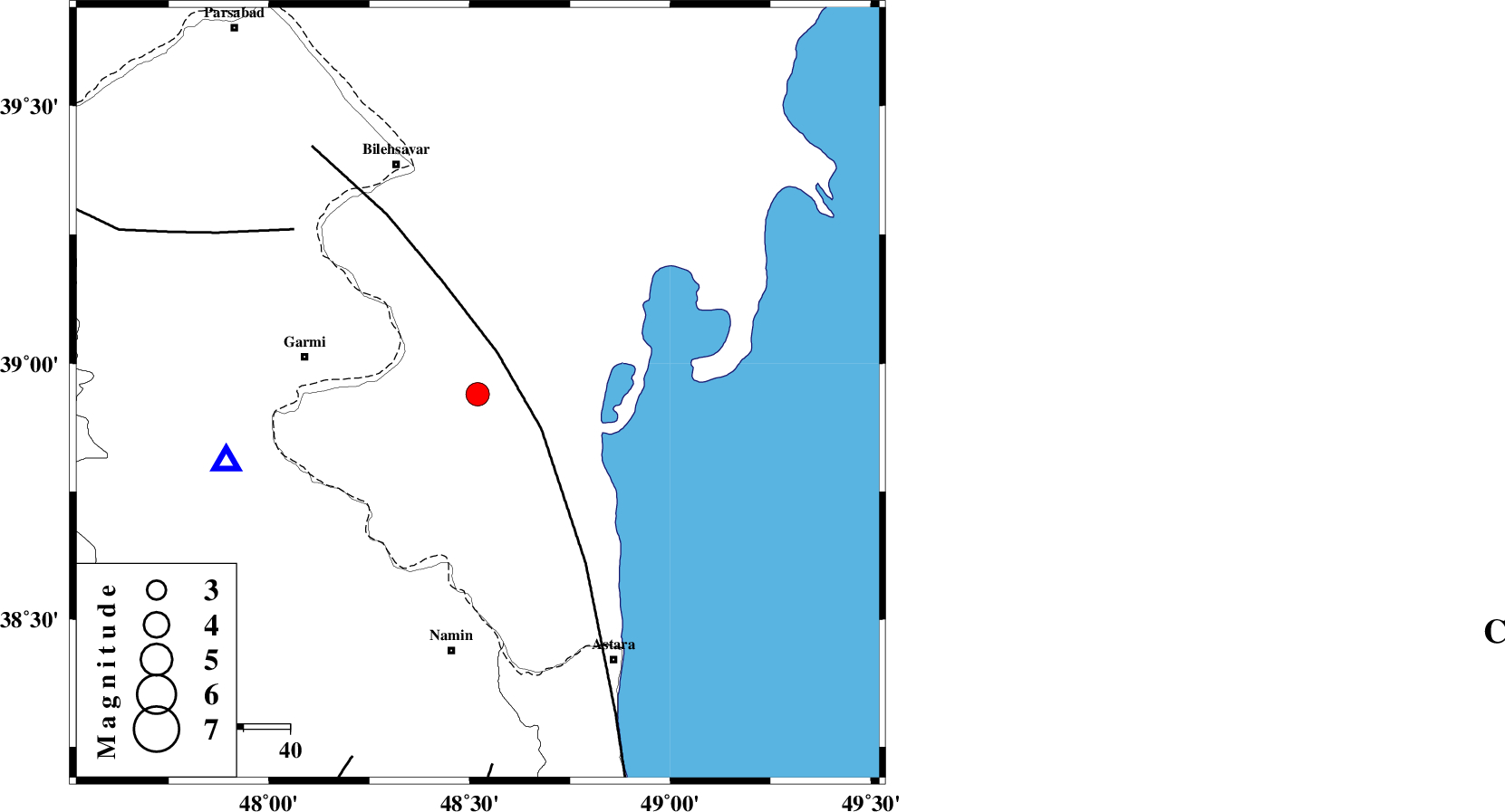
| Location | Lat:38.94 Lon: 48.52 |
| Region | 38 km East of Germi, Ardebil Province |
Nearest Cities |
|
| 25 km South East of Hasan khanlu, Ardebil Province | |
| 35 km South East of Seyyedzahra, Ardebil Province | |
| 38 km East of Germi, Ardebil Province | |
| 40 km East of Qasem kandi, Ardebil Province | |
| 44 km North East of Lurun, Ardebil Province | |
| Depth | 33 km |
| Agency | |
Faults within 150 km: |
|
| TALESH_F (Length: 258 km) , Distance to epicenter: 10 km | |
| DASHT_E_MOGHAN__ (Length: 104 km) , Distance to epicenter: 53 km | |
| SANGAVAR_F (Length: 61 km) , Distance to epicenter: 81 km | |
| Number of Phases | 6 |
| RMS | 0.4 |
| Number of Stations | 5 |
| Error in Latitude | >13.2 km |
| Error in Longitude | 14.9 km |
| Error in Depth | 10 km |
Download waveform in seisan format
to download seisan software Click here
to access information about IIEES stations Click here
Amplitude | ||||||||
| UID | Agency | Station | Component | Amplitude | Period | Arrival Time | Proccessing Time | Signal Clip |
| 31359 | IIEES | GRMI | N | 6519 | 0.12 | 2004-12-13 02:02:51 | 2006-03-15 11:56:00 | n |
| 31360 | IIEES | MAKU | N | 110.4 | 0.56 | 2004-12-13 02:04:13 | 2006-03-15 11:56:00 | n |
Phase | ||||||||||||
| Agency | Station | Component | Phase Type | Phase Quality | First Motion | Observed Arrival Time | Time Residual | Loc. Flag | Input Weight | Distance | Azimuth | |
| IIEES | GRMI | Z | PG | E | 2004-12-13 02:02:43 | 0.3 | y | 56.4 | 256 | |||
| IIEES | GRMI | N | SG | E | 2004-12-13 02:02:50 | -0.3 | y | 56.4 | 256 | |||
| IIEES | MAKU | Z | PN | E | 2004-12-13 02:03:20 | -0.1 | y | 335 | 279 | |||
| IIEES | SNGE | Z | PN | E | 2004-12-13 02:03:33 | 0.5 | y | 439 | 194 | |||
| IIEES | ASAO | Z | PN | E | 2004-12-13 02:03:40 | -0.5 | y | 505 | 164 | |||
| IIEES | NASN | Z | PN | E | 2004-12-13 02:04:16 | 0 | y | 783 | 149 | |||