
Magnitude |
:2.9 |
| Date & Time (UTC) | 2004-12-05 06:44:24.6 |
| Date & Time (Local) | 1383/9/15 10:14:24.6 |
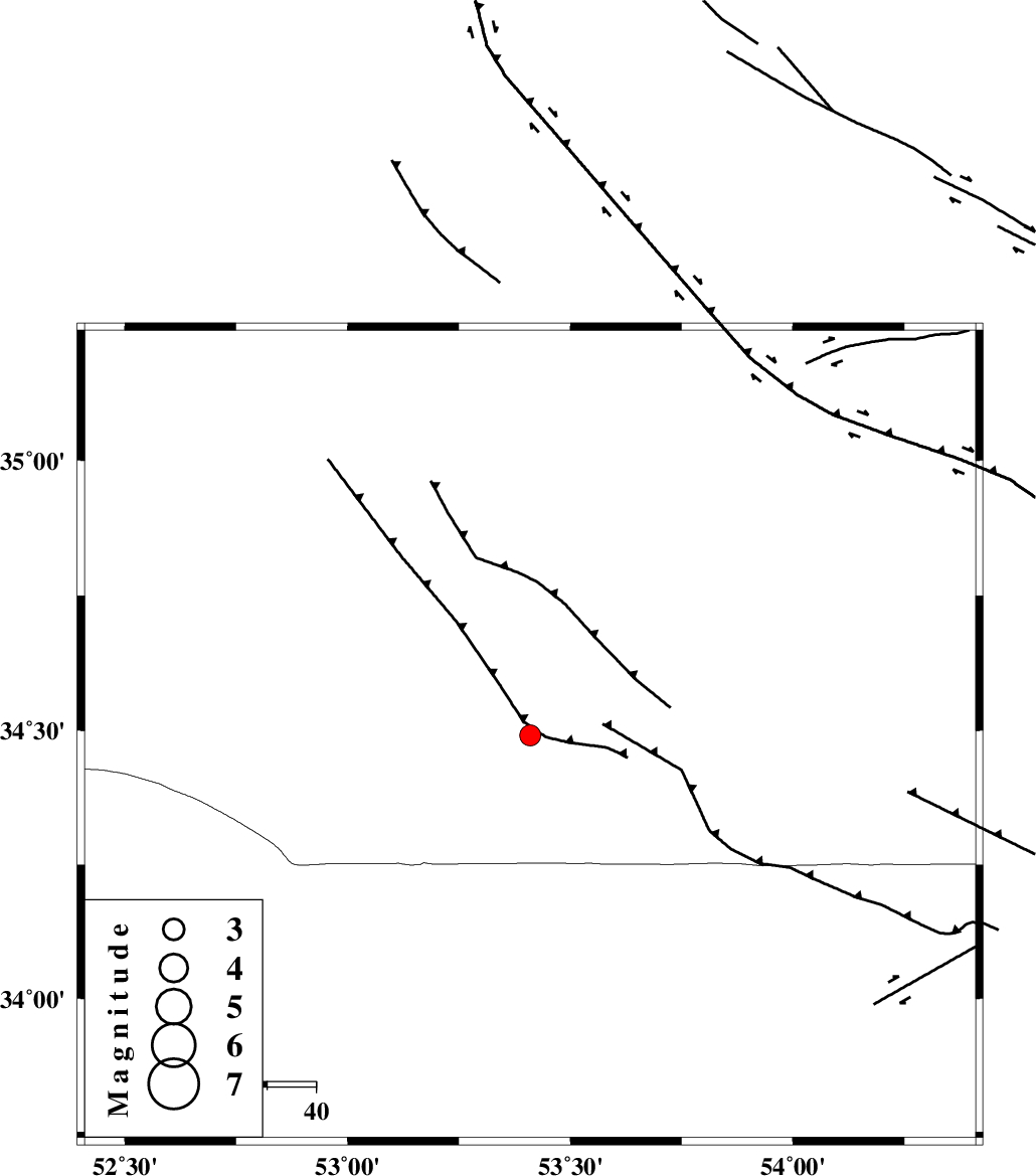
| Location | Lat:34.49 Lon: 53.41 |
| Region | 120 km South of Semnan, Semnan Province |
Nearest Cities |
|
| 94 km North of Maedan, Esfahan Province | |
| 105 km North West of Jondaq, Esfahan Province | |
| 106 km South East of Lasjerd, Semnan Province | |
| 109 km South East of Sorkheh, Semnan Province | |
| 113 km South East of Kohanabad, Semnan Province | |
| Depth | 14 km |
| Agency | |
Faults within 150 km: |
|
| KUH_E_GUGERD_F (Length: 73 km) , Distance to epicenter: 55 km | |
| KUH_E_GACHAB_F1 (Length: 53 km) , Distance to epicenter: 72 km | |
| SIAHKUH_F (Length: 154 km) , Distance to epicenter: 83 km | |
| Number of Phases | 6 |
| RMS | 0.3 |
| Number of Stations | 3 |
| Error in Latitude | >3.4 km |
| Error in Longitude | 8.6 km |
| Error in Depth | 12.1 km |
Download waveform in seisan format
to download seisan software Click here
to access information about IIEES stations Click here
Amplitude | ||||||||
| UID | Agency | Station | Component | Amplitude | Period | Arrival Time | Proccessing Time | Signal Clip |
| 31328 | IIEES | DAMV | E | 101.4 | 0.21 | 2004-12-05 06:45:20 | 2006-03-15 11:56:00 | n |
| 31329 | IIEES | NASN | E | 113.6 | 0.21 | 2004-12-05 06:45:22 | 2006-03-15 11:56:00 | n |
| 31330 | IIEES | NASN | N | 134.9 | 0.14 | 2004-12-05 06:45:22 | 2006-03-15 11:56:00 | n |
Phase | ||||||||||||
| Agency | Station | Component | Phase Type | Phase Quality | First Motion | Observed Arrival Time | Time Residual | Loc. Flag | Input Weight | Distance | Azimuth | |
| IIEES | DAMV | Z | PG | E | 2004-12-05 06:44:54 | -0.1 | y | 183 | 314 | |||
| IIEES | DAMV | E | SG | E | 2004-12-05 06:45:17 | 0.3 | y | 183 | 314 | |||
| IIEES | NASN | Z | PG | E | 2004-12-05 06:44:56 | -0.5 | y | 195 | 197 | |||
| IIEES | NASN | E | SG | E | 2004-12-05 06:45:20 | 0.5 | y | 195 | 197 | |||
| IIEES | ASAO | Z | PN | E | 2004-12-05 06:45:11 | 0.1 | y | 311 | 272 | |||
| IIEES | ASAO | N | SG | E | 2004-12-05 06:45:51 | -0.3 | y | 311 | 272 | |||