
Magnitude |
:3.2 |
| Date & Time (UTC) | 2004-12-05 06:29:09.3 |
| Date & Time (Local) | 1383/9/15 09:59:09.3 |
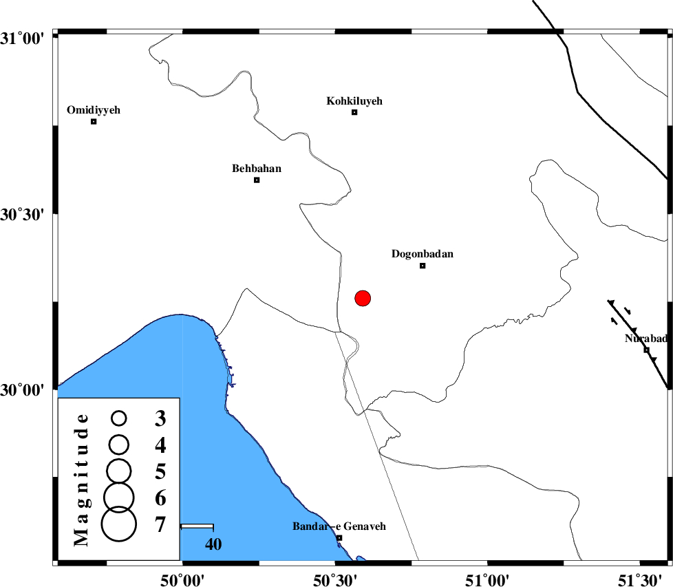
| Location | Lat:30.26 Lon: 50.59 |
| Region | 21 km West of Dogonbadan, Kohkiluieh va boyerahmad Province |
Nearest Cities |
|
| 22 km West of Dogonbadan, Kohkiluieh va boyerahmad Province | |
| 33 km North East of Siyahmakan-e bozorg, Bushehr Province | |
| 36 km East of Sardasht, Khoozestan Province | |
| 40 km North East of Ameri, Bushehr Province | |
| 49 km South West of Abdehgah, Kohkiluieh va boyerahmad Province | |
| Depth | 15 km |
| Agency | |
Faults within 150 km: |
|
| RAG_E_SEFID_F (Length: 84 km) , Distance to epicenter: 25 km | |
| ZFF3 (Length: 125 km) , Distance to epicenter: 25 km | |
| MISHAN_F (Length: 76 km) , Distance to epicenter: 28 km | |
| Number of Phases | 7 |
| RMS | 0.3 |
| Number of Stations | 7 |
| Error in Latitude | >5.4 km |
| Error in Longitude | 2.8 km |
| Error in Depth | 0 km |
Download waveform in seisan format
to download seisan software Click here
to access information about IIEES stations Click here
Amplitude | ||||||||
| UID | Agency | Station | Component | Amplitude | Period | Arrival Time | Proccessing Time | Signal Clip |
| 31324 | IIEES | SHGO | E | 157.2 | 0.55 | 2004-12-05 06:30:41 | 2006-03-15 11:56:00 | n |
| 31325 | IIEES | SHGO | N | 105.3 | 0.55 | 2004-12-05 06:30:44 | 2006-03-15 11:56:00 | n |
| 31326 | IIEES | GHIR | E | 66.7 | 0.52 | 2004-12-05 06:30:51 | 2006-03-15 11:56:00 | n |
| 31327 | IIEES | GHIR | N | 72.2 | 0.52 | 2004-12-05 06:31:01 | 2006-03-15 11:56:00 | n |
Phase | ||||||||||||
| Agency | Station | Component | Phase Type | Phase Quality | First Motion | Observed Arrival Time | Time Residual | Loc. Flag | Input Weight | Distance | Azimuth | |
| IIEES | SHGO | Z | PN | E | 2004-12-05 06:29:50 | 0.3 | y | 267 | 321 | |||
| IIEES | GHIR | Z | PN | E | 2004-12-05 06:29:56 | -0.1 | y | 319 | 133 | |||
| IIEES | NASN | Z | PN | E | 2004-12-05 06:30:00 | 0.1 | y | 352 | 36 | |||
| IIEES | ASAO | Z | PN | E | 2004-12-05 06:30:16 | 0.2 | y | 479 | 354 | |||
| IIEES | KRBR | Z | PN | E | 2004-12-05 06:30:31 | 0.1 | y | 595 | 91 | |||
| IIEES | DAMV | Z | PN | E | 2004-12-05 06:30:32 | -0.3 | y | 610 | 12 | |||
| IIEES | SNGE | Z | PN | E | 2004-12-05 06:30:32 | -0.7 | y | 616 | 331 | |||