
Magnitude |
:3.1 |
| Date & Time (UTC) | 2004-12-05 00:30:30.4 |
| Date & Time (Local) | 1383/9/15 04:00:30.4 |
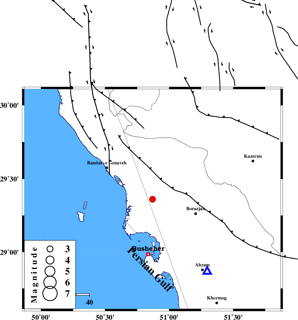
| Location | Lat:29.36 Lon: 50.87 |
| Region | 34 km West of Borazjan, Bushehr Province |
Nearest Cities |
|
| 11 km North of Kareband, Bushehr Province | |
| 12 km North of Shabankareh, Bushehr Province | |
| 17 km South West of Dehkohneh, Bushehr Province | |
| 21 km North West of Ziyarat, Bushehr Province | |
| 23 km South of Chehar rustaee, Bushehr Province | |
| Depth | 14 km |
| Agency | |
Faults within 150 km: |
|
| ZFF3 (Length: 125 km) , Distance to epicenter: 21 km | |
| BORAZJAN_F (Length: 168 km) , Distance to epicenter: 42 km | |
| ZFF2 (Length: 84 km) , Distance to epicenter: 55 km | |
| Number of Phases | 6 |
| RMS | 0.3 |
| Number of Stations | 6 |
| Error in Latitude | >16.9 km |
| Error in Longitude | 10.1 km |
| Error in Depth | 24.3 km |
Download waveform in seisan format
to download seisan software Click here
to access information about IIEES stations Click here
Amplitude | ||||||||
| UID | Agency | Station | Component | Amplitude | Period | Arrival Time | Proccessing Time | Signal Clip |
| 31309 | IIEES | GHIR | E | 126 | 0.6 | 2004-12-05 00:31:52 | 2006-03-15 11:56:00 | n |
| 31310 | IIEES | GHIR | N | 86.7 | 0.92 | 2004-12-05 00:32:00 | 2006-03-15 11:56:00 | n |
| 31311 | IIEES | SHGO | E | 52.4 | 0.5 | 2004-12-05 00:32:30 | 2006-03-15 11:56:00 | n |
| 31312 | IIEES | SHGO | N | 48.6 | 0.7 | 2004-12-05 00:32:46 | 2006-03-15 11:56:00 | n |
Phase | ||||||||||||
| Agency | Station | Component | Phase Type | Phase Quality | First Motion | Observed Arrival Time | Time Residual | Loc. Flag | Input Weight | Distance | Azimuth | |
| IIEES | GHIR | Z | PG | E | 2004-12-05 00:31:09 | -0.1 | y | 238 | 119 | |||
| IIEES | SHGO | Z | PN | E | 2004-12-05 00:31:23 | 0.2 | y | 364 | 328 | |||
| IIEES | NASN | Z | PN | E | 2004-12-05 00:31:30 | -0.2 | y | 424 | 25 | |||
| IIEES | KRBR | Z | PN | E | 2004-12-05 00:31:50 | 0.3 | y | 574 | 82 | |||
| IIEES | ASAO | Z | PN | E | 2004-12-05 00:31:50 | 0.2 | y | 581 | 352 | |||
| IIEES | SNGE | Z | PN | E | 2004-12-05 00:32:06 | -0.5 | y | 718 | 333 | |||