
Magnitude |
:3.1 |
| Date & Time (UTC) | 2004-11-28 23:18:01.4 |
| Date & Time (Local) | 1383/9/9 02:48:01.4 |
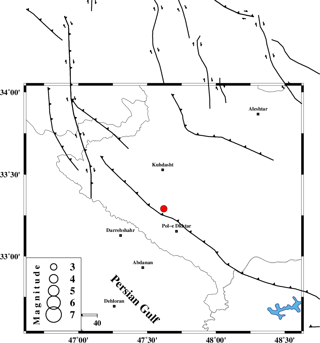
| Location | Lat:33.29 Lon: 47.62 |
| Region | 17 km North of Pol-e dokhtar, Lorestan Province |
Nearest Cities |
|
| 11 km North West of Morani, Lorestan Province | |
| 14 km North East of Chaqabol, Lorestan Province | |
| 17 km East of Suri, Lorestan Province | |
| 18 km North of Pol-e dokhtar, Lorestan Province | |
| 22 km North of Sarab hammam, Lorestan Province | |
| Depth | 46 km |
| Agency | |
Faults within 150 km: |
|
| BALARUD_F_Z1 (Length: 87 km) , Distance to epicenter: 39 km | |
| HZF4 (Length: 492 km) , Distance to epicenter: 55 km | |
| BALARUD_F_Z3 (Length: 53 km) , Distance to epicenter: 64 km | |
| Number of Phases | 5 |
| RMS | 0.1 |
| Number of Stations | 3 |
| Error in Latitude | >5.3 km |
| Error in Longitude | 13.7 km |
| Error in Depth | 6.1 km |
Download waveform in seisan format
to download seisan software Click here
to access information about IIEES stations Click here
Amplitude | ||||||||
| UID | Agency | Station | Component | Amplitude | Period | Arrival Time | Proccessing Time | Signal Clip |
| 31258 | IIEES | SHGR | N | 247.7 | 0.52 | 2004-11-28 23:18:57 | 2006-03-15 11:56:00 | n |
| 31259 | IIEES | SHGR | E | 254.4 | 0.64 | 2004-11-28 23:19:05 | 2006-03-15 11:56:00 | n |
| 31260 | IIEES | SNGE | N | 146.8 | 0.56 | 2004-11-28 23:19:11 | 2006-03-15 11:56:00 | n |
Phase | ||||||||||||
| Agency | Station | Component | Phase Type | Phase Quality | First Motion | Observed Arrival Time | Time Residual | Loc. Flag | Input Weight | Distance | Azimuth | |
| IIEES | SHGR | Z | PG | E | 2004-11-28 23:18:29 | -0.1 | y | 171 | 139 | |||
| IIEES | SHGR | E | SG | E | 2004-11-28 23:18:50 | 0.2 | y | 171 | 139 | |||
| IIEES | SNGE | Z | PG | E | 2004-11-28 23:18:34 | 0 | y | 202 | 353 | |||
| IIEES | SNGE | N | SG | E | 2004-11-28 23:18:58 | 0.1 | y | 202 | 353 | |||
| IIEES | NASN | Z | PN | E | 2004-11-28 23:19:06 | -0.2 | y | 487 | 95 | |||