
Magnitude |
:3.2 |
| Date & Time (UTC) | 2004-11-27 10:49:25.7 |
| Date & Time (Local) | 1383/9/7 14:19:25.7 |
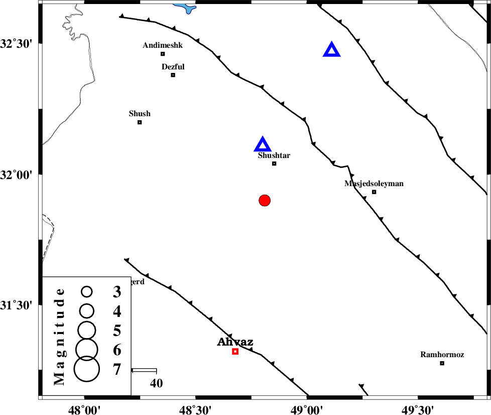
| Location | Lat:31.9 Lon: 48.81 |
| Region | 16 km South of Shushtar, Khoozestan Province |
Nearest Cities |
|
| 6 km of Mehdiabad, Khoozestan Province | |
| 11 km North of Arabhasan, Khoozestan Province | |
| 13 km South of Sardarabad, Khoozestan Province | |
| 16 km South of Shushtar, Khoozestan Province | |
| 33 km South of Samaleh, Khoozestan Province | |
| Depth | 11 km |
| Agency | |
Faults within 150 km: |
|
| DEZFUL_EMBAYMENT (Length: 228 km) , Distance to epicenter: 32 km | |
| AHVAZ_F (Length: 99 km) , Distance to epicenter: 54 km | |
| MFF2 (Length: 205 km) , Distance to epicenter: 72 km | |
| Number of Phases | 6 |
| RMS | 0.3 |
| Number of Stations | 6 |
| Error in Latitude | >6.6 km |
| Error in Longitude | 9.6 km |
| Error in Depth | 5.7 km |
Download waveform in seisan format
to download seisan software Click here
to access information about IIEES stations Click here
Amplitude | ||||||||
| UID | Agency | Station | Component | Amplitude | Period | Arrival Time | Proccessing Time | Signal Clip |
| 31245 | IIEES | SNGE | N | 86.4 | 0.64 | 2004-11-27 10:51:30 | 2006-03-15 11:56:00 | n |
| 31246 | IIEES | NASN | N | 28.3 | 0.46 | 2004-11-27 10:51:29 | 2006-03-15 11:56:00 | n |
| 31247 | IIEES | NASN | E | 50.4 | 0.68 | 2004-11-27 10:51:30 | 2006-03-15 11:56:00 | n |
Phase | ||||||||||||
| Agency | Station | Component | Phase Type | Phase Quality | First Motion | Observed Arrival Time | Time Residual | Loc. Flag | Input Weight | Distance | Azimuth | |
| IIEES | SHGO | Z | PG | E | 2004-11-27 10:49:30 | 0 | y | 23.6 | 358 | |||
| IIEES | SNGE | Z | PN | E | 2004-11-27 10:50:21 | 0.2 | y | 380 | 339 | |||
| IIEES | NASN | Z | PN | E | 2004-11-27 10:50:22 | 0.4 | y | 390 | 74 | |||
| IIEES | THKV | Z | PN | E | 2004-11-27 10:50:33 | -0.3 | y | 485 | 23 | |||
| IIEES | DAMV | Z | PN | E | 2004-11-27 10:50:36 | -0.3 | y | 507 | 34 | |||
| IIEES | GHIR | Z | PN | E | 2004-11-27 10:50:44 | -0.2 | y | 568 | 134 | |||