
Magnitude |
:2.8 |
| Date & Time (UTC) | 2004-11-25 07:44:03.8 |
| Date & Time (Local) | 1383/9/5 11:14:03.8 |
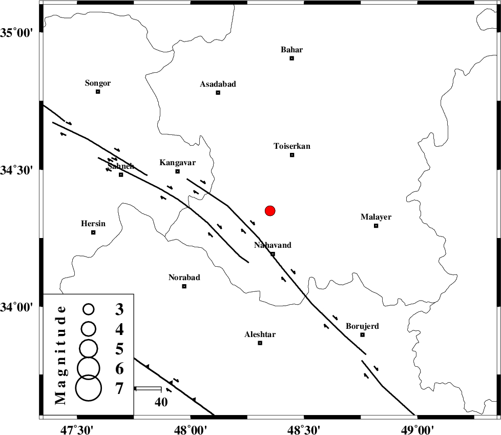
| Location | Lat:34.35 Lon: 48.35 |
| Region | 17 km North of Nahavand, Hamedan Province |
Nearest Cities |
|
| 8 km of Miyandeh, Hamedan Province | |
| 13 km North of Dehghul, Hamedan Province | |
| 16 km South of Farsang, Hamedan Province | |
| 16 km North West of Avarzman, Hamedan Province | |
| 16 km North of Barzul, Hamedan Province | |
| Depth | 14 km |
| Agency | |
Faults within 150 km: |
|
| NAHAVAND_F (Length: 102 km) , Distance to epicenter: 12 km | |
| SAHANEH_F (Length: 77 km) , Distance to epicenter: 22 km | |
| DINEHVAR_F (Length: 46 km) , Distance to epicenter: 52 km | |
| Number of Phases | 5 |
| RMS | 0.1 |
| Number of Stations | 5 |
| Error in Latitude | >6.7 km |
| Error in Longitude | 4.1 km |
| Error in Depth | 5.5 km |
Download waveform in seisan format
to download seisan software Click here
to access information about IIEES stations Click here
Amplitude | ||||||||
| UID | Agency | Station | Component | Amplitude | Period | Arrival Time | Proccessing Time | Signal Clip |
| 31217 | IIEES | SNGE | N | 288.4 | 0.48 | 2004-11-25 07:44:55 | 2006-03-15 11:56:00 | n |
| 31218 | IIEES | ASAO | E | 123.8 | 0.68 | 2004-11-25 07:45:18 | 2006-03-15 11:56:00 | n |
Phase | ||||||||||||
| Agency | Station | Component | Phase Type | Phase Quality | First Motion | Observed Arrival Time | Time Residual | Loc. Flag | Input Weight | Distance | Azimuth | |
| IIEES | SNGE | Z | PG | E | 2004-11-25 07:44:24 | -0.1 | y | 123 | 312 | |||
| IIEES | ASAO | E | PG | E | 2004-11-25 07:44:29 | -0.2 | y | 156 | 81 | |||
| IIEES | THKV | Z | PN | E | 2004-11-25 07:44:47 | 0.2 | y | 289 | 52 | |||
| IIEES | DAMV | Z | PN | E | 2004-11-25 07:44:56 | 0.1 | y | 360 | 66 | |||
| IIEES | NASN | Z | PN | E | 2004-11-25 07:45:07 | 0.1 | y | 448 | 111 | |||