
Magnitude |
:2.8 |
| Date & Time (UTC) | 2004-11-21 23:27:07.0 |
| Date & Time (Local) | 1383/9/2 02:57:07.0 |
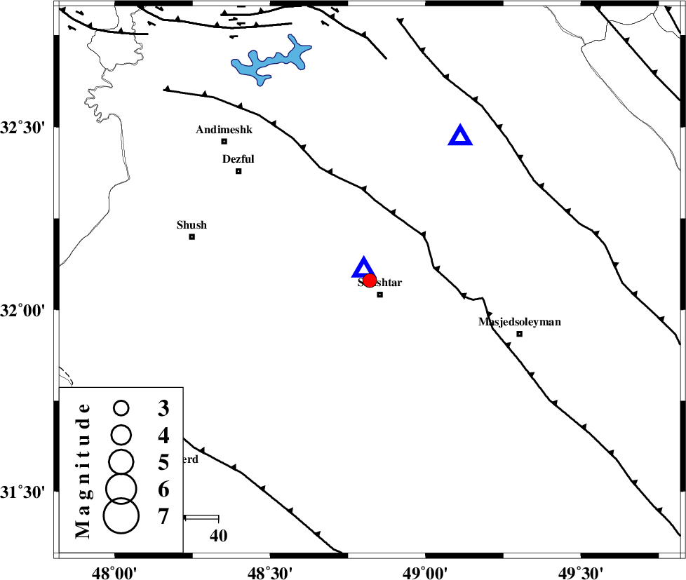
| Location | Lat:32.08 Lon: 48.82 |
| Region | 5 km Shushtar, Khoozestan Province |
Nearest Cities |
|
| 5 km North of Shushtar, Khoozestan Province | |
| 8 km North of Sardarabad, Khoozestan Province | |
| 14 km South of Samaleh, Khoozestan Province | |
| 15 km North of Mehdiabad, Khoozestan Province | |
| 18 km South of Gatvand, Khoozestan Province | |
| Depth | 14 km |
| Agency | |
Faults within 150 km: |
|
| DEZFUL_EMBAYMENT (Length: 228 km) , Distance to epicenter: 20 km | |
| MFF2 (Length: 205 km) , Distance to epicenter: 58 km | |
| BALARUD_F_Z2 (Length: 58 km) , Distance to epicenter: 67 km | |
| Number of Phases | 5 |
| RMS | 0.5 |
| Number of Stations | 4 |
| Error in Latitude | >9.1 km |
| Error in Longitude | 14.1 km |
| Error in Depth | 7.4 km |
Download waveform in seisan format
to download seisan software Click here
to access information about IIEES stations Click here
Amplitude | ||||||||
| UID | Agency | Station | Component | Amplitude | Period | Arrival Time | Proccessing Time | Signal Clip |
| 31152 | IIEES | ASAO | N | 48.5 | 0.64 | 2004-11-21 23:28:36 | 2006-03-15 11:56:00 | n |
| 31153 | IIEES | ASAO | E | 28.2 | 0.68 | 2004-11-21 23:28:46 | 2006-03-15 11:56:00 | n |
| 31154 | IIEES | SNGE | N | 29.8 | 0.4 | 2004-11-21 23:28:54 | 2006-03-15 11:56:00 | n |
Phase | ||||||||||||
| Agency | Station | Component | Phase Type | Phase Quality | First Motion | Observed Arrival Time | Time Residual | Loc. Flag | Input Weight | Distance | Azimuth | |
| IIEES | SHGO | Z | PG | E | 2004-11-21 23:27:08 | -0.6 | y | 3.95 | 336 | |||
| IIEES | ASAO | Z | PN | E | 2004-11-21 23:27:52 | 0.8 | y | 296 | 22 | |||
| IIEES | ASAO | N | SG | E | 2004-11-21 23:28:30 | -0.3 | y | 296 | 22 | |||
| IIEES | SNGE | Z | PN | E | 2004-11-21 23:27:59 | 0.3 | y | 361 | 338 | |||
| IIEES | NASN | Z | PN | E | 2004-11-21 23:28:02 | 0 | y | 384 | 77 | |||