
Magnitude |
:2.9 |
| Date & Time (UTC) | 2004-11-21 05:24:27.8 |
| Date & Time (Local) | 1383/9/1 08:54:27.8 |
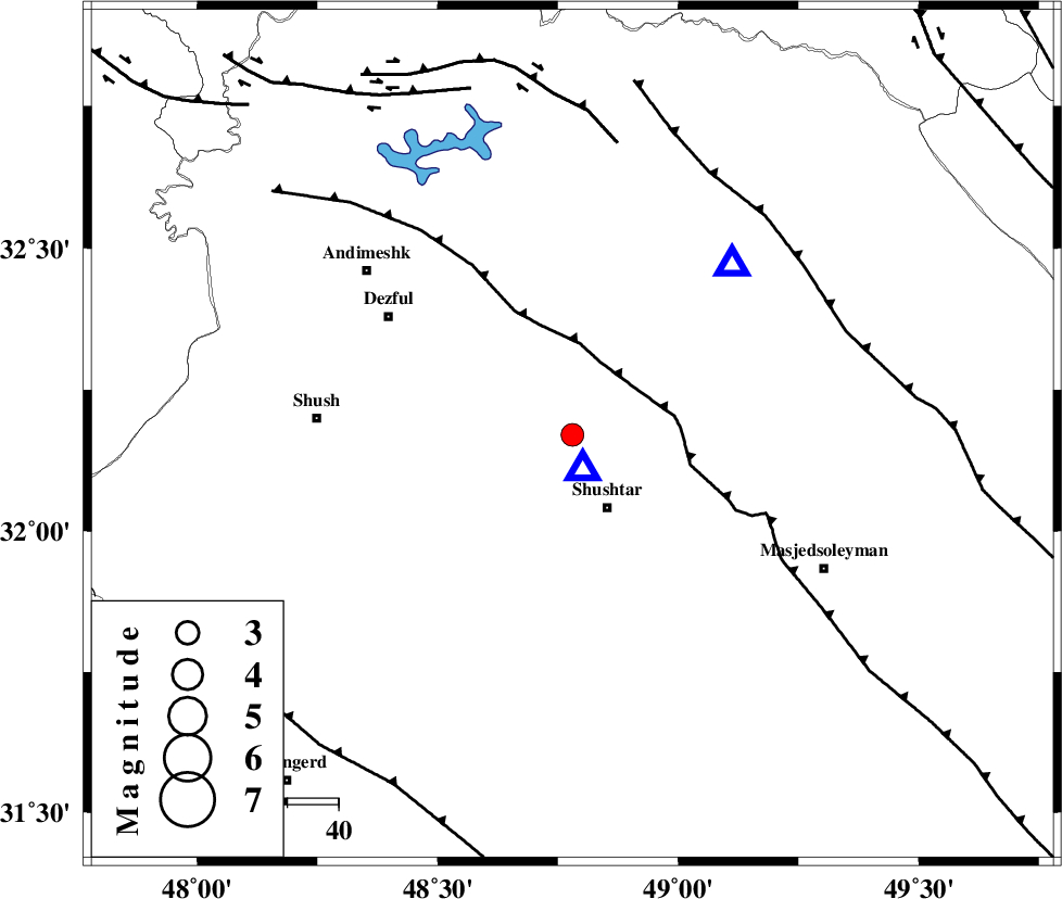
| Location | Lat:32.17 Lon: 48.78 |
| Region | 15 km North of Shushtar, Khoozestan Province |
Nearest Cities |
|
| 7 km of Samaleh, Khoozestan Province | |
| 9 km of Gatvand, Khoozestan Province | |
| 16 km North of Shushtar, Khoozestan Province | |
| 17 km North of Sardarabad, Khoozestan Province | |
| 26 km North of Mehdiabad, Khoozestan Province | |
| Depth | 6 km |
| Agency | |
Faults within 150 km: |
|
| DEZFUL_EMBAYMENT (Length: 228 km) , Distance to epicenter: 15 km | |
| MFF2 (Length: 205 km) , Distance to epicenter: 56 km | |
| BALARUD_F_Z2 (Length: 58 km) , Distance to epicenter: 58 km | |
| Number of Phases | 5 |
| RMS | 0.4 |
| Number of Stations | 3 |
| Error in Latitude | >8.5 km |
| Error in Longitude | 25.4 km |
| Error in Depth | 15.5 km |
Download waveform in seisan format
to download seisan software Click here
to access information about IIEES stations Click here
Amplitude | ||||||||
| UID | Agency | Station | Component | Amplitude | Period | Arrival Time | Proccessing Time | Signal Clip |
| 31133 | IIEES | ASAO | N | 72.2 | 0.52 | 2004-11-21 05:25:56 | 2006-03-15 11:56:00 | n |
| 31134 | IIEES | ASAO | E | 45.7 | 0.39 | 2004-11-21 05:26:01 | 2006-03-15 11:56:00 | n |
| 31135 | IIEES | SNGE | E | 13.7 | 0.55 | 2004-11-21 05:26:02 | 2006-03-15 11:56:00 | n |
| 31136 | IIEES | SNGE | N | 47.6 | 0.36 | 2004-11-21 05:26:03 | 2006-03-15 11:56:00 | n |
Phase | ||||||||||||
| Agency | Station | Component | Phase Type | Phase Quality | First Motion | Observed Arrival Time | Time Residual | Loc. Flag | Input Weight | Distance | Azimuth | |
| IIEES | SHGO | Z | PG | E | 2004-11-21 05:24:28 | -0.6 | y | 6.67 | 160 | |||
| IIEES | SHGO | N | SG | E | 2004-11-21 05:24:31 | 0.3 | y | 6.67 | 160 | |||
| IIEES | ASAO | Z | PN | E | 2004-11-21 05:25:13 | 0.6 | y | 289 | 23 | |||
| IIEES | ASAO | N | SG | E | 2004-11-21 05:25:53 | -0.3 | y | 289 | 23 | |||
| IIEES | SNGE | Z | PN | E | 2004-11-21 05:25:20 | -0.1 | y | 351 | 338 | |||