
Magnitude |
:3.3 |
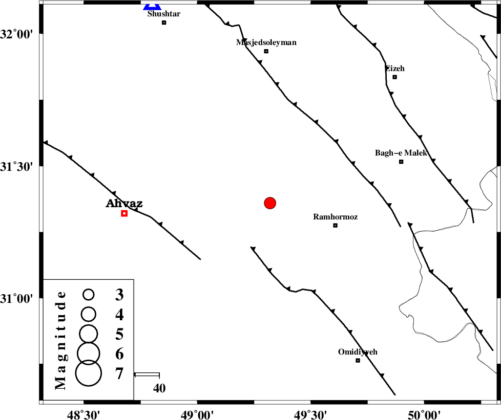
| Date & Time (UTC) | 2004-11-19 20:11:06.3 |
| Date & Time (Local) | 1383/8/29 23:41:06.3 |
| Location | Lat:31.36 Lon: 49.32 |
| Region | 29 km West of Ramhormoz, Khoozestan Province |
Nearest Cities |
|
| 14 km North West of Marbacheh, Khoozestan Province | |
| 22 km West of Haftgol, Khoozestan Province | |
| 23 km South of Gazin, Khoozestan Province | |
| 29 km North West of Ramhormoz, Khoozestan Province | |
| 30 km South West of Jaru, Khoozestan Province | |
| Depth | 15 km |
| Agency | |
Faults within 150 km: |
|
| AGHAJARI_F (Length: 88 km) , Distance to epicenter: 20 km | |
| AHVAZ_F (Length: 99 km) , Distance to epicenter: 38 km | |
| DEZFUL_EMBAYMENT (Length: 228 km) , Distance to epicenter: 38 km | |
| Number of Phases | 5 |
| RMS | 0.6 |
| Number of Stations | 5 |
| Error in Latitude | >36.3 km |
| Error in Longitude | 7.4 km |
| Error in Depth | 0 km |
Download waveform in seisan format
to download seisan software Click here
to access information about IIEES stations Click here
Amplitude | ||||||||
| UID | Agency | Station | Component | Amplitude | Period | Arrival Time | Proccessing Time | Signal Clip |
| 31044 | IIEES | ASAO | E | 75.7 | 0.56 | 2004-11-19 20:12:56 | 2004-12-11 10:15:00 | n |
| 31045 | IIEES | ASAO | N | 66.5 | 0.52 | 2004-11-19 20:13:00 | 2004-12-11 10:15:00 | n |
Phase | ||||||||||||
| Agency | Station | Component | Phase Type | Phase Quality | First Motion | Observed Arrival Time | Time Residual | Loc. Flag | Input Weight | Distance | Azimuth | |
| IIEES | ASAO | Z | PN | E | 2004-11-19 20:11:59 | 0.9 | y | 359.6 | 10 | |||
| IIEES | NASN | Z | PN | E | 2004-11-19 20:11:59 | 0.1 | y | 366.2 | 63 | |||
| IIEES | SNGE | Z | PN | E | 2004-11-19 20:12:10 | -0.1 | y | 452.7 | 337 | |||
| IIEES | THKV | Z | PN | E | 2004-11-19 20:12:18 | -0.9 | y | 525.6 | 16 | |||
| IIEES | DAMV | Z | PN | E | 2004-11-19 20:12:20 | -0.3 | y | 533.9 | 27 | |||