
Magnitude |
:4.2 |
| Date & Time (UTC) | 2004-11-19 17:29:31.3 |
| Date & Time (Local) | 1383/8/29 20:59:31.3 |
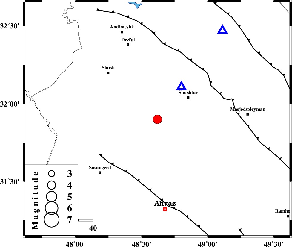
| Location | Lat:31.9 Lon: 48.62 |
| Region | 26 km South-West of Shushtar, Khoozestan Province |
Nearest Cities |
|
| 21 km South West of Sardarabad, Khoozestan Province | |
| 22 km West of Mehdiabad, Khoozestan Province | |
| 24 km North East of Abdolkhan-eali, Khoozestan Province | |
| 27 km North West of Arabhasan, Khoozestan Province | |
| 27 km South West of Shushtar, Khoozestan Province | |
| Depth | 14 km |
| Agency | |
Faults within 150 km: |
|
| AHVAZ_F (Length: 99 km) , Distance to epicenter: 44 km | |
| DEZFUL_EMBAYMENT (Length: 228 km) , Distance to epicenter: 45 km | |
| MFF2 (Length: 205 km) , Distance to epicenter: 85 km | |
| Number of Phases | 4 |
| RMS | 0.3 |
| Number of Stations | 4 |
| Error in Latitude | >8.1 km |
| Error in Longitude | 10 km |
| Error in Depth | 0 km |
Download waveform in seisan format
to download seisan software Click here
to access information about IIEES stations Click here
Amplitude | ||||||||
| UID | Agency | Station | Component | Amplitude | Period | Arrival Time | Proccessing Time | Signal Clip |
| 31030 | IIEES | ASAO | N | 796.3 | 0.48 | 2004-11-19 17:31:08 | 2006-03-15 11:56:00 | n |
| 31031 | IIEES | ASAO | E | 456.5 | 0.56 | 2004-11-19 17:31:14 | 2006-03-15 11:56:00 | n |
| 31032 | IIEES | NASN | N | 421 | 0.68 | 2004-11-19 17:31:29 | 2006-03-15 11:56:00 | n |
| 31033 | IIEES | NASN | E | 372.3 | 0.55 | 2004-11-19 17:31:35 | 2006-03-15 11:56:00 | n |
| 31034 | IIEES | THKV | E | 184.2 | 0.66 | 2004-11-19 17:31:52 | 2006-03-15 11:56:00 | n |
| 31035 | IIEES | THKV | N | 194.3 | 0.57 | 2004-11-19 17:31:56 | 2006-03-15 11:56:00 | n |
| 31036 | IIEES | GHIR | E | 206 | 0.67 | 2004-11-19 17:32:40 | 2006-03-15 11:56:00 | n |
| 31037 | IIEES | GHIR | N | 264.3 | 0.57 | 2004-11-19 17:32:59 | 2006-03-15 11:56:00 | n |
Phase | ||||||||||||
| Agency | Station | Component | Phase Type | Phase Quality | First Motion | Observed Arrival Time | Time Residual | Loc. Flag | Input Weight | Distance | Azimuth | |
| IIEES | ASAO | Z | PN | E | 2004-11-19 17:30:19 | 0.3 | y | 321 | 24 | |||
| IIEES | NASN | Z | PN | E | 2004-11-19 17:30:29 | 0 | y | 406 | 75 | |||
| IIEES | THKV | Z | PN | E | 2004-11-19 17:30:39 | -0.4 | y | 492 | 24 | |||
| IIEES | GHIR | Z | PN | E | 2004-11-19 17:30:51 | 0 | y | 581 | 133 | |||