
Magnitude |
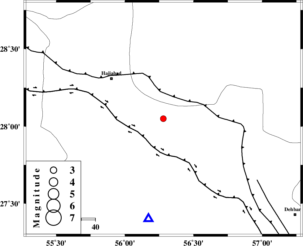
:2.8 |
| Date & Time (UTC) | 2004-11-18 22:35:33.8 |
| Date & Time (Local) | 1383/8/29 02:05:33.8 |
| Location | Lat:28.05 Lon: 56.28 |
| Region | 46 km South-East of Hajiabad, Hormozgan Province |
Nearest Cities |
|
| 6 km North of Fareqan, Hormozgan Province | |
| 44 km South of Arzuieeh, Kerman Province | |
| 46 km South West of Shahmaran, Kerman Province | |
| 47 km South East of Hajiabad, Hormozgan Province | |
| 59 km North East of Fin, Hormozgan Province | |
| Depth | 16 km |
| Agency | |
Faults within 150 km: |
|
| MAIN_ZAGROS_R_F (Length: 1106 km) , Distance to epicenter: 17 km | |
| HZF2 (Length: 437 km) , Distance to epicenter: 19 km | |
| ZENDAN_MINAB_F_Z1 (Length: 183 km) , Distance to epicenter: 80 km | |
| Number of Phases | 4 |
| RMS | 0.1 |
| Number of Stations | 3 |
| Error in Latitude | >0.3 km |
| Error in Longitude | 2.9 km |
| Error in Depth | 0 km |
Download waveform in seisan format
to download seisan software Click here
to access information about IIEES stations Click here
Amplitude | ||||||||
| UID | Agency | Station | Component | Amplitude | Period | Arrival Time | Proccessing Time | Signal Clip |
| 30999 | IIEES | BNDS | E | 571.7 | 0.51 | 2004-11-18 22:36:01 | 2006-03-15 11:56:00 | n |
| 31000 | IIEES | BNDS | N | 535.8 | 0.39 | 2004-11-18 22:36:03 | 2006-03-15 11:56:00 | n |
| 31001 | IIEES | KRBR | N | 76.8 | 0.37 | 2004-11-18 22:36:43 | 2006-03-15 11:56:00 | n |
| 31002 | IIEES | KRBR | E | 101.9 | 0.51 | 2004-11-18 22:36:43 | 2006-03-15 11:56:00 | n |
| 31003 | IIEES | GHIR | N | 23.9 | 0.8 | 2004-11-18 22:37:15 | 2006-03-15 11:56:00 | n |
| 31004 | IIEES | GHIR | E | 35.9 | 0.57 | 2004-11-18 22:37:19 | 2006-03-15 11:56:00 | n |
Phase | ||||||||||||
| Agency | Station | Component | Phase Type | Phase Quality | First Motion | Observed Arrival Time | Time Residual | Loc. Flag | Input Weight | Distance | Azimuth | |
| IIEES | BNDS | Z | PG | E | 2004-11-18 22:35:46 | 0.1 | y | 73.1 | 188 | |||
| IIEES | BNDS | N | SG | E | 2004-11-18 22:35:55 | -0.1 | y | 73.1 | 188 | |||
| IIEES | KRBR | Z | PG | E | 2004-11-18 22:36:09 | 0 | y | 219 | 12 | |||
| IIEES | GHIR | Z | PN | E | 2004-11-18 22:36:21 | 0 | y | 324 | 275 | |||