
Magnitude |
:3 |
| Date & Time (UTC) | 2004-11-18 01:03:40.8 |
| Date & Time (Local) | 1383/8/28 04:33:40.8 |
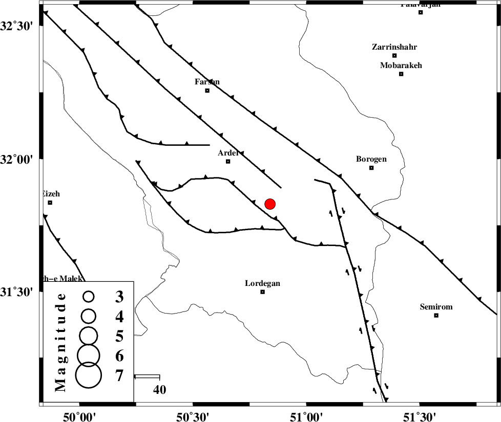
| Location | Lat:31.83 Lon: 50.84 |
| Region | 25 km South-East of Ardel, Chaharmahal Bakhtiari Province |
Nearest Cities |
|
| 15 km South East of Naghan, Chaharmahal Bakhtiari Province | |
| 22 km North of Armand-e olia, Chaharmahal Bakhtiari Province | |
| 23 km West of Baladaji, Chaharmahal Bakhtiari Province | |
| 24 km South of Shalamzar, Chaharmahal Bakhtiari Province | |
| 24 km East of Dupelan, Chaharmahal Bakhtiari Province | |
| Depth | 14 km |
| Agency | |
Faults within 150 km: |
|
| DOPOLAN_F (Length: 107 km) , Distance to epicenter: 6 km | |
| ARDAL_F (Length: 170 km) , Distance to epicenter: 8 km | |
| SABZKUH_F (Length: 67 km) , Distance to epicenter: 12 km | |
| Number of Phases | 4 |
| RMS | 0 |
| Number of Stations | 3 |
| Error in Latitude | >15.2 km |
| Error in Longitude | 2.3 km |
| Error in Depth | 10.5 km |
Download waveform in seisan format
to download seisan software Click here
to access information about IIEES stations Click here
Amplitude | ||||||||
| UID | Agency | Station | Component | Amplitude | Period | Arrival Time | Proccessing Time | Signal Clip |
| 30986 | IIEES | SHGR | N | 253.4 | 0.52 | 2004-11-18 01:04:46 | 2006-03-15 11:56:00 | n |
| 30987 | IIEES | NASN | N | 69.2 | 0.46 | 2004-11-18 01:04:53 | 2006-03-15 11:56:00 | n |
| 30988 | IIEES | ASAO | N | 75.9 | 0.58 | 2004-11-18 01:05:13 | 2006-03-15 11:56:00 | n |
Phase | ||||||||||||
| Agency | Station | Component | Phase Type | Phase Quality | First Motion | Observed Arrival Time | Time Residual | Loc. Flag | Input Weight | Distance | Azimuth | |
| IIEES | SHGR | Z | PG | E | 2004-11-18 01:04:12 | 0 | y | 195 | 280 | |||
| IIEES | SHGR | N | SG | E | 2004-11-18 01:04:36 | 0 | y | 195 | 280 | |||
| IIEES | NASN | Z | PG | E | 2004-11-18 01:04:16 | 0 | y | 215 | 59 | |||
| IIEES | ASAO | Z | PN | E | 2004-11-18 01:04:27 | 0 | y | 311 | 346 | |||