
Magnitude |
:2.9 |
| Date & Time (UTC) | 2004-11-17 19:29:04.1 |
| Date & Time (Local) | 1383/8/27 22:59:04.1 |
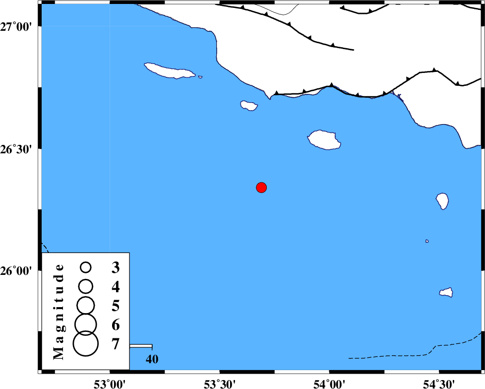
| Location | Lat:26.34 Lon: 53.69 |
| Region | Persian Gulf |
Nearest Cities |
|
| 92 km South of Ahl, Fars Province | |
| 96 km South West of Jenah, Hormozgan Province | |
| 98 km South of Ashkenan, Fars Province | |
| 116 km South West of Bastak, Hormozgan Province | |
| 117 km South West of Bandar-e lengeh, Hormozgan Province | |
| Depth | 18 km |
| Agency | |
Faults within 150 km: |
|
| ZFF1 (Length: 165 km) , Distance to epicenter: 43 km | |
| MFF3 (Length: 292 km) , Distance to epicenter: 71 km | |
| MFF1 (Length: 180 km) , Distance to epicenter: 89 km | |
| Number of Phases | 4 |
| RMS | 0.1 |
| Number of Stations | 3 |
| Error in Latitude | >12.7 km |
| Error in Longitude | 35 km |
| Error in Depth | 35.6 km |
Download waveform in seisan format
to download seisan software Click here
to access information about IIEES stations Click here
Amplitude | ||||||||
| UID | Agency | Station | Component | Amplitude | Period | Arrival Time | Proccessing Time | Signal Clip |
| 30981 | IIEES | GHIR | N | 93.8 | 0.33 | 2004-11-17 19:30:10 | 2006-03-15 11:56:00 | n |
| 30982 | IIEES | GHIR | E | 115.1 | 0.48 | 2004-11-17 19:30:15 | 2006-03-15 11:56:00 | n |
| 30983 | IIEES | BNDS | E | 54.5 | 0.47 | 2004-11-17 19:30:29 | 2006-03-15 11:56:00 | n |
| 30984 | IIEES | BNDS | N | 54.4 | 0.54 | 2004-11-17 19:30:30 | 2006-03-15 11:56:00 | n |
| 30985 | IIEES | KRBR | E | 13.7 | 0.55 | 2004-11-17 19:31:07 | 2006-03-15 11:56:00 | n |
Phase | ||||||||||||
| Agency | Station | Component | Phase Type | Phase Quality | First Motion | Observed Arrival Time | Time Residual | Loc. Flag | Input Weight | Distance | Azimuth | |
| IIEES | GHIR | Z | PG | E | 2004-11-17 19:29:41 | 0 | y | 226 | 342 | |||
| IIEES | GHIR | E | SG | E | 2004-11-17 19:30:08 | 0 | y | 226 | 342 | |||
| IIEES | BNDS | Z | PN | E | 2004-11-17 19:29:45 | 0.1 | y | 273 | 64 | |||
| IIEES | KRBR | Z | PN | E | 2004-11-17 19:30:14 | -0.2 | y | 504 | 36 | |||