
Magnitude |
:2.9 |
| Date & Time (UTC) | 2004-11-16 01:32:29.7 |
| Date & Time (Local) | 1383/8/26 05:02:29.7 |
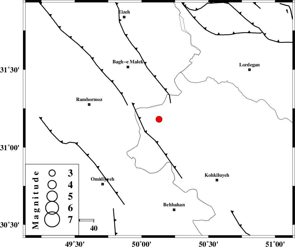
| Location | Lat:31.18 Lon: 50.13 |
| Region | 44 km South-East of Bagh Malek, Khoozestan Province |
Nearest Cities |
|
| 19 km South West of Esfandan, Kohkiluieh va boyerahmad Province | |
| 20 km South of Seidun, Khoozestan Province | |
| 28 km South East of Dalan, Khoozestan Province | |
| 28 km South West of Dishmuk, Kohkiluieh va boyerahmad Province | |
| 30 km West of Qale-ye raiesi, Kohkiluieh va boyerahmad Province | |
| Depth | 34 km |
| Agency | |
Faults within 150 km: |
|
| MFF4 (Length: 62 km) , Distance to epicenter: 13 km | |
| MFF2 (Length: 205 km) , Distance to epicenter: 14 km | |
| DEZFUL_EMBAYMENT (Length: 228 km) , Distance to epicenter: 24 km | |
| Number of Phases | 4 |
| RMS | 0 |
| Number of Stations | 3 |
| Error in Latitude | >9.9 km |
| Error in Longitude | 5.3 km |
| Error in Depth | 6.1 km |
Download waveform in seisan format
to download seisan software Click here
to access information about IIEES stations Click here
Amplitude | ||||||||
| UID | Agency | Station | Component | Amplitude | Period | Arrival Time | Proccessing Time | Signal Clip |
| 30974 | IIEES | SHGR | N | 336.9 | 0.31 | 2004-11-16 01:33:17 | 2006-03-15 11:56:00 | n |
| 30975 | IIEES | NASN | N | 13.3 | 0.76 | 2004-11-16 01:34:08 | 2006-03-15 11:56:00 | n |
| 30976 | IIEES | SNGE | N | 17.2 | 0.58 | 2004-11-16 01:34:33 | 2006-03-15 11:56:00 | n |
Phase | ||||||||||||
| Agency | Station | Component | Phase Type | Phase Quality | First Motion | Observed Arrival Time | Time Residual | Loc. Flag | Input Weight | Distance | Azimuth | |
| IIEES | SHGR | Z | PG | E | 2004-11-16 01:32:56 | 0 | y | 163 | 310 | |||
| IIEES | SHGR | N | SG | E | 2004-11-16 01:33:15 | 0 | y | 163 | 310 | |||
| IIEES | NASN | Z | PN | E | 2004-11-16 01:33:14 | 0 | y | 311 | 54 | |||
| IIEES | SNGE | Z | PN | E | 2004-11-16 01:33:38 | 0 | y | 506 | 330 | |||