
Magnitude |
:3.1 |
| Date & Time (UTC) | 2004-11-08 20:36:59.0 |
| Date & Time (Local) | 1383/8/19 00:06:59.0 |
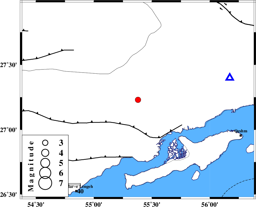
| Location | Lat:27.23 Lon: 55.38 |
| Region | 89 km West of Bandar-e abbas, Hormozgan Province |
Nearest Cities |
|
| 37 km North West of Bandar-e khamir, Hormozgan Province | |
| 69 km South West of Fin, Hormozgan Province | |
| 71 km South of Darz, Fars Province | |
| 84 km North West of Suza, Hormozgan Province | |
| 89 km North West of Bandar-e abbas, Hormozgan Province | |
| Depth | 32 km |
| Agency | |
Faults within 150 km: |
|
| MFF1 (Length: 180 km) , Distance to epicenter: 23 km | |
| ZFF1 (Length: 165 km) , Distance to epicenter: 49 km | |
| LAR_F (Length: 99 km) , Distance to epicenter: 69 km | |
| Number of Phases | 5 |
| RMS | 0.1 |
| Number of Stations | 4 |
| Error in Latitude | >6 km |
| Error in Longitude | 1.6 km |
| Error in Depth | 2.8 km |
Download waveform in seisan format
to download seisan software Click here
to access information about IIEES stations Click here
Amplitude | ||||||||
| UID | Agency | Station | Component | Amplitude | Period | Arrival Time | Proccessing Time | Signal Clip |
| 30841 | IIEES | BNDS | E | 563.8 | 0.38 | 2004-11-08 20:37:32 | 2006-03-15 11:56:00 | n |
| 30842 | IIEES | BNDS | N | 611.4 | 0.38 | 2004-11-08 20:37:39 | 2006-03-15 11:56:00 | n |
| 30843 | IIEES | GHIR | N | 159.3 | 0.6 | 2004-11-08 20:38:18 | 2006-03-15 11:56:00 | n |
| 30844 | IIEES | GHIR | E | 120.3 | 0.65 | 2004-11-08 20:38:28 | 2006-03-15 11:56:00 | n |
| 30845 | IIEES | KRBR | E | 43.5 | 0.41 | 2004-11-08 20:38:31 | 2006-03-15 11:56:00 | n |
| 30846 | IIEES | KRBR | N | 37.7 | 0.92 | 2004-11-08 20:38:39 | 2006-03-15 11:56:00 | n |
Phase | ||||||||||||
| Agency | Station | Component | Phase Type | Phase Quality | First Motion | Observed Arrival Time | Time Residual | Loc. Flag | Input Weight | Distance | Azimuth | |
| IIEES | BNDS | Z | PG | E | 2004-11-08 20:37:13 | 0 | y | 80.9 | 76 | |||
| IIEES | GHIR | Z | PN | E | 2004-11-08 20:37:37 | 0 | y | 263 | 297 | |||
| IIEES | GHIR | N | SG | E | 2004-11-08 20:38:11 | 0 | y | 263 | 297 | |||
| IIEES | KRBR | Z | PN | E | 2004-11-08 20:37:46 | 0 | y | 334 | 24 | |||
| IIEES | ZHSF | Z | PN | E | 2004-11-08 20:38:18 | 0.1 | y | 591 | 62 | |||