
Magnitude |
:3.7 |
| Date & Time (UTC) | 2004-11-07 18:02:54.2 |
| Date & Time (Local) | 1383/8/17 21:32:54.2 |
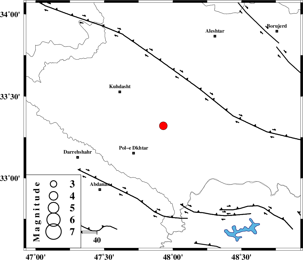
| Location | Lat:33.32 Lon: 47.93 |
| Region | 26 km North-East of Pol-e dokhtar, Lorestan Province |
Nearest Cities |
|
| 7 km of Maeulan, Lorestan Province | |
| 21 km North East of Morani, Lorestan Province | |
| 21 km South West of Mahmudvand, Lorestan Province | |
| 25 km South West of Godar-e mahmudvand, Lorestan Province | |
| 26 km West of Shoorab-e sofla, Lorestan Province | |
| Depth | 15 km |
| Agency | |
Faults within 150 km: |
|
| HZF4 (Length: 492 km) , Distance to epicenter: 35 km | |
| BALARUD_F_Z1 (Length: 87 km) , Distance to epicenter: 53 km | |
| BALARUD_F_Z3 (Length: 53 km) , Distance to epicenter: 55 km | |
| Number of Phases | 5 |
| RMS | 0.1 |
| Number of Stations | 5 |
| Error in Latitude | >5.1 km |
| Error in Longitude | 11.9 km |
| Error in Depth | 9.9 km |
Download waveform in seisan format
to download seisan software Click here
to access information about IIEES stations Click here
Amplitude | ||||||||
| UID | Agency | Station | Component | Amplitude | Period | Arrival Time | Proccessing Time | Signal Clip |
| 30822 | IIEES | SHGR | N | 1562.7 | 0.64 | 2004-11-07 18:03:44 | 2006-03-15 11:56:00 | n |
| 30823 | IIEES | SHGR | E | 1536.7 | 0.88 | 2004-11-07 18:03:50 | 2006-03-15 11:56:00 | n |
| 30824 | IIEES | SNGE | N | 963 | 0.44 | 2004-11-07 18:03:58 | 2006-03-15 11:56:00 | n |
| 30825 | IIEES | THKV | E | 111.4 | 0.6 | 2004-11-07 18:04:56 | 2006-03-15 11:56:00 | n |
| 30826 | IIEES | THKV | N | 92.8 | 0.6 | 2004-11-07 18:04:58 | 2006-03-15 11:56:00 | n |
Phase | ||||||||||||
| Agency | Station | Component | Phase Type | Phase Quality | First Motion | Observed Arrival Time | Time Residual | Loc. Flag | Input Weight | Distance | Azimuth | |
| IIEES | SHGR | Z | PG | E | 2004-11-07 18:03:20 | 0 | y | 157 | 148 | |||
| IIEES | SNGE | Z | PG | E | 2004-11-07 18:03:27 | 0 | y | 204 | 345 | |||
| IIEES | THKV | Z | PN | E | 2004-11-07 18:03:51 | 0.2 | y | 395 | 42 | |||
| IIEES | DAMV | Z | PN | E | 2004-11-07 18:03:57 | -0.2 | y | 451 | 54 | |||
| IIEES | GRMI | Z | PN | E | 2004-11-07 18:04:17 | 0 | y | 610 | 360 | |||