
Magnitude |
:2.2 |
| Date & Time (UTC) | 2004-11-07 15:08:47.5 |
| Date & Time (Local) | 1383/8/17 18:38:47.5 |
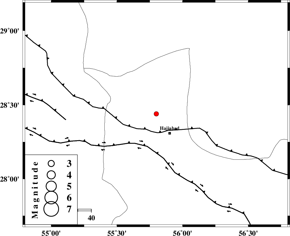
| Location | Lat:28.44 Lon: 55.8 |
| Region | 17 km North of Hajiabad, Hormozgan Province |
Nearest Cities |
|
| 18 km North West of Hajiabad, Hormozgan Province | |
| 47 km South East of Tal bargah, Fars Province | |
| 55 km North West of Arzuieeh, Kerman Province | |
| 57 km West of Shahmaran, Kerman Province | |
| 60 km North East of Doborji, Fars Province | |
| Depth | 15 km |
| Agency | |
Faults within 150 km: |
|
| MAIN_ZAGROS_R_F (Length: 1106 km) , Distance to epicenter: 14 km | |
| HZF2 (Length: 437 km) , Distance to epicenter: 25 km | |
| HZF1 (Length: 102 km) , Distance to epicenter: 67 km | |
| Number of Phases | 3 |
| RMS | 0 |
| Number of Stations | 3 |
| Error in Latitude | >1.5 km |
| Error in Longitude | 2.3 km |
| Error in Depth | 0 km |
Download waveform in seisan format
to download seisan software Click here
to access information about IIEES stations Click here
Amplitude | ||||||||
| UID | Agency | Station | Component | Amplitude | Period | Arrival Time | Proccessing Time | Signal Clip |
| 30814 | IIEES | BNDS | N | 49.9 | 0.36 | 2004-11-07 15:09:30 | 2006-03-15 11:56:00 | n |
| 30815 | IIEES | BNDS | E | 49.8 | 0.28 | 2004-11-07 15:09:32 | 2006-03-15 11:56:00 | n |
| 30816 | IIEES | GHIR | E | 11.7 | 0.56 | 2004-11-07 15:10:10 | 2006-03-15 11:56:00 | n |
| 30817 | IIEES | GHIR | N | 11 | 0.25 | 2004-11-07 15:10:17 | 2006-03-15 11:56:00 | n |
Phase | ||||||||||||
| Agency | Station | Component | Phase Type | Phase Quality | First Motion | Observed Arrival Time | Time Residual | Loc. Flag | Input Weight | Distance | Azimuth | |
| IIEES | BNDS | Z | PG | E | 2004-11-07 15:09:07 | 0 | y | 121 | 162 | |||
| IIEES | KRBR | Z | PG | E | 2004-11-07 15:09:19 | 0 | y | 195 | 28 | |||
| IIEES | GHIR | Z | PN | E | 2004-11-07 15:09:29 | 0 | y | 277 | 267 | |||