
Magnitude |
:3.2 |
| Date & Time (UTC) | 2004-11-07 01:15:16.9 |
| Date & Time (Local) | 1383/8/17 04:45:16.9 |
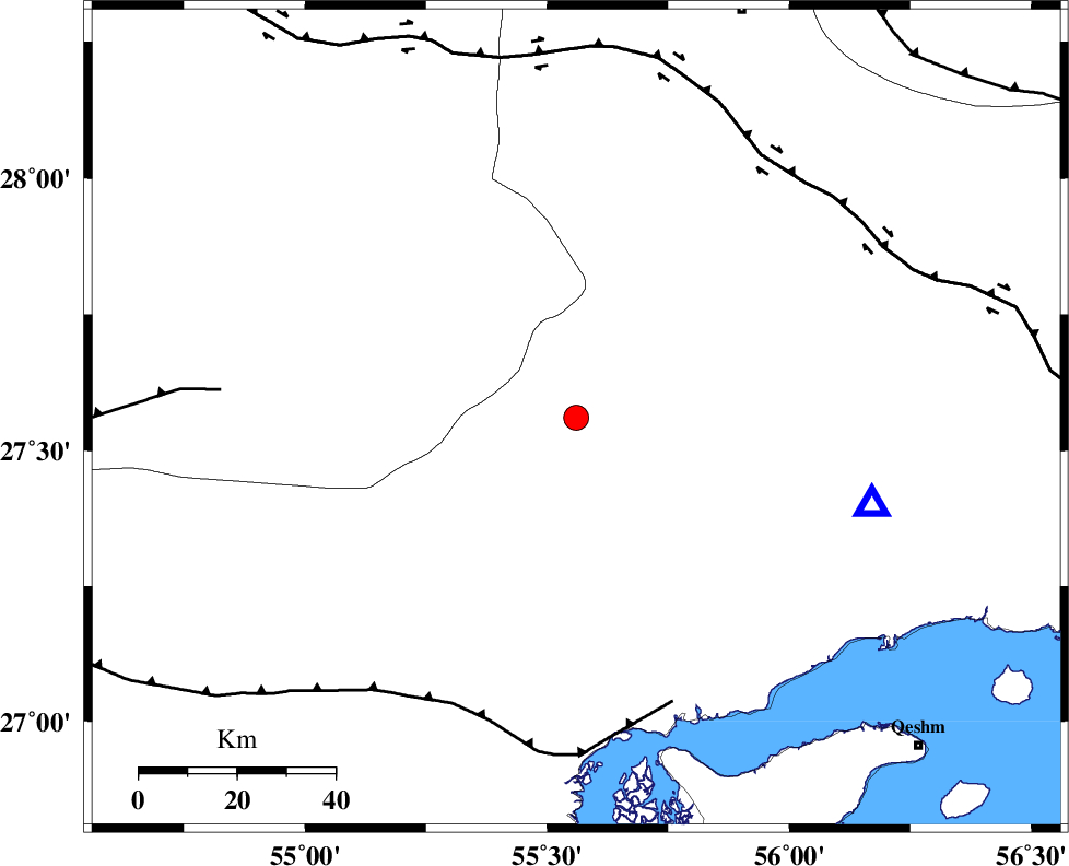
| Location | Lat:27.56 Lon: 55.56 |
| Region | 82 km North-West of Bandar-e abbas, Hormozgan Province |
Nearest Cities |
|
| 35 km West of Fin, Hormozgan Province | |
| 36 km South East of Darz, Fars Province | |
| 68 km North of Bandar-e khamir, Hormozgan Province | |
| 81 km South East of Fadami, Fars Province | |
| 83 km North West of Bandar-e abbas, Hormozgan Province | |
| Depth | 14 km |
| Agency | |
Faults within 150 km: |
|
| MFF1 (Length: 180 km) , Distance to epicenter: 61 km | |
| HZF2 (Length: 437 km) , Distance to epicenter: 66 km | |
| LAR_F (Length: 99 km) , Distance to epicenter: 73 km | |
| Number of Phases | 4 |
| RMS | 0 |
| Number of Stations | 3 |
| Error in Latitude | >4.2 km |
| Error in Longitude | 1.6 km |
| Error in Depth | 4.3 km |
Download waveform in seisan format
to download seisan software Click here
to access information about IIEES stations Click here
Amplitude | ||||||||
| UID | Agency | Station | Component | Amplitude | Period | Arrival Time | Proccessing Time | Signal Clip |
| 30783 | IIEES | BNDS | N | 1196.8 | 0.64 | 2004-11-07 01:15:49 | 2006-03-15 11:56:00 | n |
| 30784 | IIEES | BNDS | E | 1237.1 | 0.56 | 2004-11-07 01:16:01 | 2006-03-15 11:56:00 | n |
| 30785 | IIEES | GHIR | E | 144.4 | 0.52 | 2004-11-07 01:16:42 | 2006-03-15 11:56:00 | n |
| 30786 | IIEES | GHIR | N | 201.9 | 0.52 | 2004-11-07 01:16:56 | 2006-03-15 11:56:00 | n |
| 30787 | IIEES | KRBR | E | 76.9 | 0.52 | 2004-11-07 01:16:51 | 2006-03-15 11:56:00 | n |
| 30788 | IIEES | KRBR | N | 79.5 | 0.56 | 2004-11-07 01:16:53 | 2006-03-15 11:56:00 | n |
Phase | ||||||||||||
| Agency | Station | Component | Phase Type | Phase Quality | First Motion | Observed Arrival Time | Time Residual | Loc. Flag | Input Weight | Distance | Azimuth | |
| IIEES | BNDS | Z | PG | E | 2004-11-07 01:15:28 | 0 | y | 62.7 | 106 | |||
| IIEES | GHIR | Z | PN | E | 2004-11-07 01:15:57 | 0 | y | 266 | 288 | |||
| IIEES | GHIR | N | SG | E | 2004-11-07 01:16:32 | 0 | y | 266 | 288 | |||
| IIEES | KRBR | Z | PN | E | 2004-11-07 01:16:01 | 0 | y | 293 | 23 | |||