
Magnitude |
:4.3 |
| Date & Time (UTC) | 2004-11-06 23:42:23.5 |
| Date & Time (Local) | 1383/8/17 03:12:23.5 |
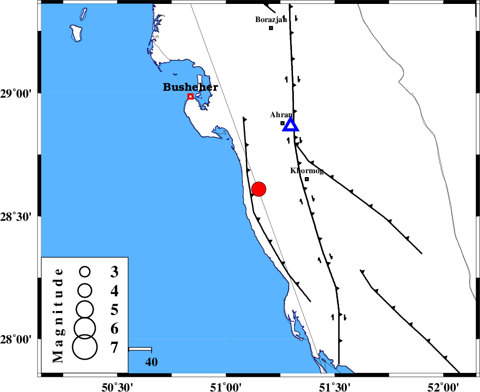
| Location | Lat:28.61 Lon: 51.15 |
| Region | 22 km West of Khormog, Bushehr Province |
Nearest Cities |
|
| 8 km of Derazi, Bushehr Province | |
| 19 km South of Delvar, Bushehr Province | |
| 22 km North West of Buheyri, Bushehr Province | |
| 22 km West of Khormog, Bushehr Province | |
| 32 km South West of Ahram, Bushehr Province | |
| Depth | 18 km |
| Agency | |
Faults within 150 km: |
|
| ZFF2 (Length: 84 km) , Distance to epicenter: 5 km | |
| BORAZJAN_F (Length: 168 km) , Distance to epicenter: 19 km | |
| MFF5 (Length: 74 km) , Distance to epicenter: 26 km | |
| Number of Phases | 4 |
| RMS | 0 |
| Number of Stations | 3 |
| Error in Latitude | >9.6 km |
| Error in Longitude | 5.5 km |
| Error in Depth | 6 km |
Download waveform in seisan format
to download seisan software Click here
to access information about IIEES stations Click here
Amplitude | ||||||||
| UID | Agency | Station | Component | Amplitude | Period | Arrival Time | Proccessing Time | Signal Clip |
| 30775 | IIEES | GHIR | N | 3936.4 | 0.76 | 2004-11-06 23:43:19 | 2006-03-15 11:56:00 | n |
| 30776 | IIEES | GHIR | E | 3086.5 | 0.6 | 2004-11-06 23:43:28 | 2006-03-15 11:56:00 | n |
Phase | ||||||||||||
| Agency | Station | Component | Phase Type | Phase Quality | First Motion | Observed Arrival Time | Time Residual | Loc. Flag | Input Weight | Distance | Azimuth | |
| IIEES | GHIR | Z | PG | E | 2004-11-06 23:42:53 | 0.1 | y | 184 | 101 | |||
| IIEES | GHIR | E | SG | E | 2004-11-06 23:43:15 | 0 | y | 184 | 101 | |||
| IIEES | BNDS | Z | PN | E | 2004-11-06 23:43:34 | -0.1 | y | 512 | 104 | |||
| IIEES | KRBR | Z | PN | E | 2004-11-06 23:43:41 | 0 | y | 566 | 73 | |||