
Magnitude |
:2.7 |
| Date & Time (UTC) | 2004-11-06 23:36:16.7 |
| Date & Time (Local) | 1383/8/17 03:06:16.7 |
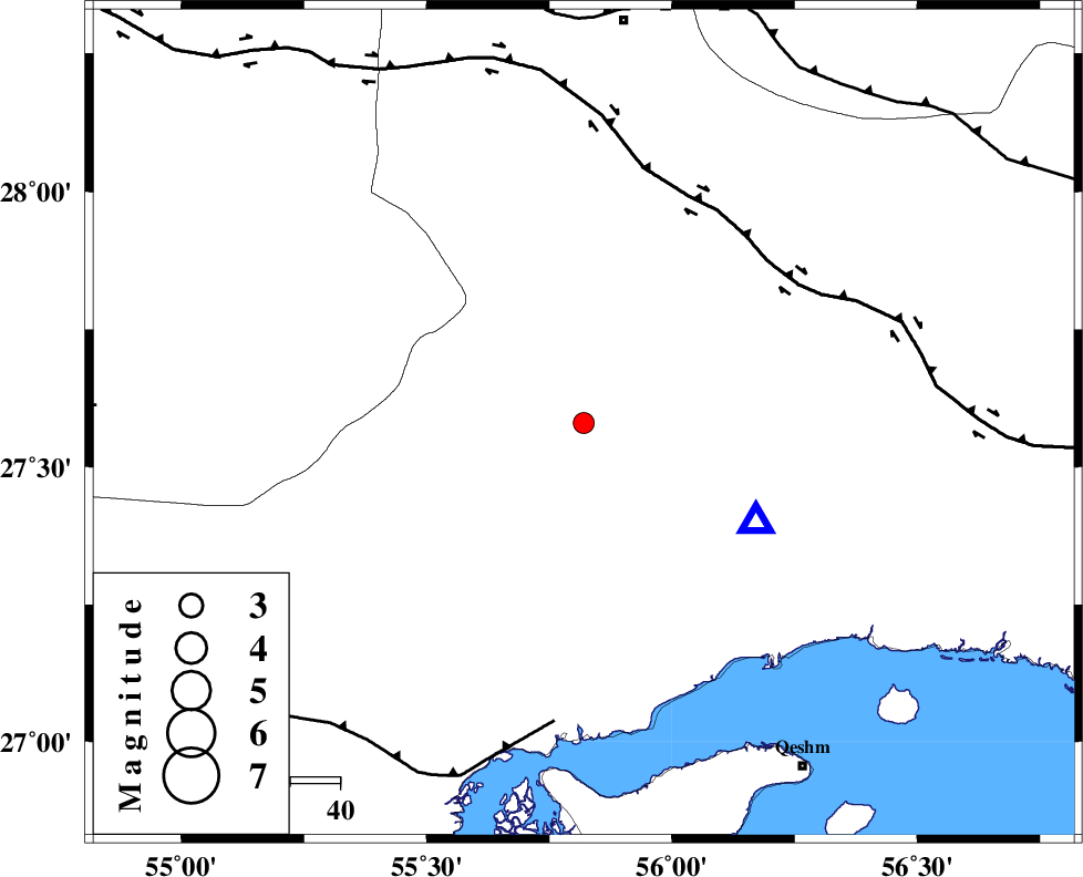
| Location | Lat:27.58 Lon: 55.82 |
| Region | 63 km North-West of Bandar-e abbas, Hormozgan Province |
Nearest Cities |
|
| 10 km of Fin, Hormozgan Province | |
| 50 km South East of Darz, Fars Province | |
| 63 km South West of Fareqan, Hormozgan Province | |
| 63 km North West of Bandar-e abbas, Hormozgan Province | |
| 74 km North East of Bandar-e khamir, Hormozgan Province | |
| Depth | 32 km |
| Agency | |
Faults within 150 km: |
|
| HZF2 (Length: 437 km) , Distance to epicenter: 49 km | |
| MFF1 (Length: 180 km) , Distance to epicenter: 61 km | |
| MAIN_ZAGROS_R_F (Length: 1106 km) , Distance to epicenter: 82 km | |
| Number of Phases | 4 |
| RMS | 0 |
| Number of Stations | 3 |
| Error in Latitude | >1.7 km |
| Error in Longitude | 8.9 km |
| Error in Depth | 2.9 km |
Download waveform in seisan format
to download seisan software Click here
to access information about IIEES stations Click here
Amplitude | ||||||||
| UID | Agency | Station | Component | Amplitude | Period | Arrival Time | Proccessing Time | Signal Clip |
| 30771 | IIEES | BNDS | N | 504.7 | 0.5 | 2004-11-06 23:36:47 | 2006-03-15 11:56:00 | n |
| 30772 | IIEES | BNDS | E | 680.6 | 0.48 | 2004-11-06 23:36:58 | 2006-03-15 11:56:00 | n |
| 30773 | IIEES | KRBR | N | 36.5 | 0.72 | 2004-11-06 23:37:45 | 2006-03-15 11:56:00 | n |
| 30774 | IIEES | KRBR | E | 31.4 | 0.52 | 2004-11-06 23:37:55 | 2006-03-15 11:56:00 | n |
Phase | ||||||||||||
| Agency | Station | Component | Phase Type | Phase Quality | First Motion | Observed Arrival Time | Time Residual | Loc. Flag | Input Weight | Distance | Azimuth | |
| IIEES | BNDS | Z | PG | E | 2004-11-06 23:36:25 | 0 | y | 40 | 120 | |||
| IIEES | KRBR | Z | PN | E | 2004-11-06 23:36:57 | 0 | y | 282 | 19 | |||
| IIEES | KRBR | N | SG | E | 2004-11-06 23:37:34 | 0 | y | 282 | 19 | |||
| IIEES | ZHSF | Z | PN | E | 2004-11-06 23:37:29 | 0 | y | 535 | 64 | |||