
Magnitude |
:4.5 |
| Date & Time (UTC) | 2004-11-06 23:19:40.6 |
| Date & Time (Local) | 1383/8/17 02:49:40.6 |
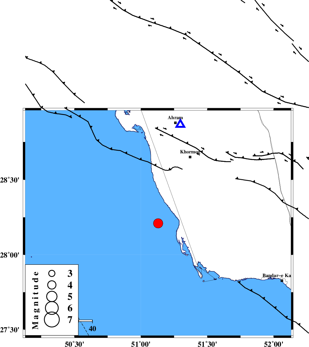
| Location | Lat:28.21 Lon: 51.13 |
| Region | Persian Gulf, 54 km South-West of Khormog |
Nearest Cities |
|
| 24 km North West of Ziyarat, Bushehr Province | |
| 38 km North West of Bardkhun, Bushehr Province | |
| 39 km North West of Abkesh, Bushehr Province | |
| 40 km South West of Kaki, Bushehr Province | |
| 41 km South West of Baduleh, Bushehr Province | |
| Depth | 40 km |
| Agency | |
Faults within 150 km: |
|
| ZFF2 (Length: 84 km) , Distance to epicenter: 17 km | |
| BORAZJAN_F (Length: 168 km) , Distance to epicenter: 35 km | |
| MFF3 (Length: 292 km) , Distance to epicenter: 48 km | |
| Number of Phases | 7 |
| RMS | 0.4 |
| Number of Stations | 6 |
| Error in Latitude | >16.7 km |
| Error in Longitude | 11.9 km |
| Error in Depth | 13.1 km |
Download waveform in seisan format
to download seisan software Click here
to access information about IIEES stations Click here
Amplitude | ||||||||
| UID | Agency | Station | Component | Amplitude | Period | Arrival Time | Proccessing Time | Signal Clip |
| 30767 | IIEES | GHIR | N | 9263.1 | 0.48 | 2004-11-06 23:20:36 | 2006-03-15 11:56:00 | n |
| 30768 | IIEES | GHIR | E | 7695 | 0.68 | 2004-11-06 23:20:42 | 2006-03-15 11:56:00 | n |
| 30769 | IIEES | SHGR | N | 358.6 | 0.6 | 2004-11-06 23:22:08 | 2006-03-15 11:56:00 | n |
| 30770 | IIEES | SHGR | E | 312.9 | 0.6 | 2004-11-06 23:22:16 | 2006-03-15 11:56:00 | n |
Phase | ||||||||||||
| Agency | Station | Component | Phase Type | Phase Quality | First Motion | Observed Arrival Time | Time Residual | Loc. Flag | Input Weight | Distance | Azimuth | |
| IIEES | GHIR | Z | PG | E | 2004-11-06 23:20:10 | -0.3 | y | 183 | 87 | |||
| IIEES | GHIR | E | SG | E | 2004-11-06 23:20:32 | 0.3 | y | 183 | 87 | |||
| IIEES | SHGR | Z | PN | E | 2004-11-06 23:20:46 | 0.6 | y | 487 | 333 | |||
| IIEES | BNDS | Z | PN | E | 2004-11-06 23:20:49 | 0.2 | y | 505 | 99 | |||
| IIEES | KRBR | Z | PN | E | 2004-11-06 23:20:58 | -0.4 | y | 582 | 69 | |||
| IIEES | SNGE | Z | PN | E | 2004-11-06 23:21:30 | -0.4 | y | 843 | 336 | |||
| IIEES | THKV | Z | PN | E | 2004-11-06 23:21:31 | -0.5 | y | 855 | 358 | |||