
Magnitude |
:3.1 |
| Date & Time (UTC) | 2004-10-24 22:08:45.0 |
| Date & Time (Local) | 1383/8/4 01:38:45.0 |
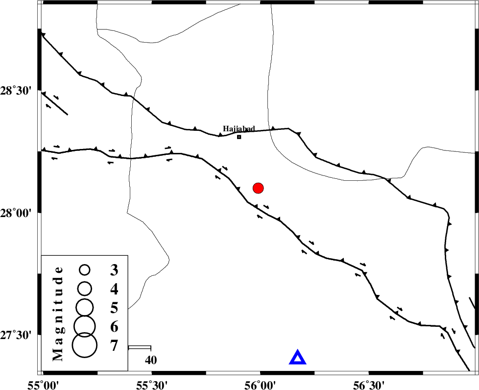
| Location | Lat:28.1 Lon: 55.99 |
| Region | 25 km South of Hajiabad, Hormozgan Province |
Nearest Cities |
|
| 25 km South of Hajiabad, Hormozgan Province | |
| 26 km North West of Fareqan, Hormozgan Province | |
| 52 km North of Fin, Hormozgan Province | |
| 52 km South West of Arzuieeh, Kerman Province | |
| 55 km South West of Shahmaran, Kerman Province | |
| Depth | 33 km |
| Agency | |
Faults within 150 km: |
|
| HZF2 (Length: 437 km) , Distance to epicenter: 8 km | |
| MAIN_ZAGROS_R_F (Length: 1106 km) , Distance to epicenter: 26 km | |
| HZF1 (Length: 102 km) , Distance to epicenter: 92 km | |
| Number of Phases | 5 |
| RMS | 0.2 |
| Number of Stations | 3 |
| Error in Latitude | >0.6 km |
| Error in Longitude | 3.2 km |
| Error in Depth | 0 km |
Download waveform in seisan format
to download seisan software Click here
to access information about IIEES stations Click here
Amplitude | ||||||||
| UID | Agency | Station | Component | Amplitude | Period | Arrival Time | Proccessing Time | Signal Clip |
| 30641 | IIEES | BNDS | E | 661.6 | 0.43 | 2004-10-24 22:09:14 | 2006-03-15 11:56:00 | n |
| 30642 | IIEES | BNDS | N | 594.7 | 0.59 | 2004-10-24 22:09:19 | 2006-03-15 11:56:00 | n |
| 30643 | IIEES | KRBR | E | 143 | 0.43 | 2004-10-24 22:09:54 | 2006-03-15 11:56:00 | n |
| 30644 | IIEES | KRBR | N | 114.1 | 0.6 | 2004-10-24 22:09:56 | 2006-03-15 11:56:00 | n |
| 30645 | IIEES | GHIR | E | 86.3 | 0.65 | 2004-10-24 22:10:19 | 2006-03-15 11:56:00 | n |
| 30646 | IIEES | GHIR | N | 81.1 | 0.43 | 2004-10-24 22:10:30 | 2006-03-15 11:56:00 | n |
Phase | ||||||||||||
| Agency | Station | Component | Phase Type | Phase Quality | First Motion | Observed Arrival Time | Time Residual | Loc. Flag | Input Weight | Distance | Azimuth | |
| IIEES | BNDS | Z | PG | E | 2004-10-24 22:08:58 | -0.1 | y | 79.2 | 167 | |||
| IIEES | BNDS | N | SG | E | 2004-10-24 22:09:09 | 0 | y | 79.2 | 167 | |||
| IIEES | KRBR | Z | PG | E | 2004-10-24 22:09:21 | 0.3 | y | 222 | 20 | |||
| IIEES | KRBR | E | SG | E | 2004-10-24 22:09:46 | -0.2 | y | 222 | 20 | |||
| IIEES | GHIR | Z | PN | E | 2004-10-24 22:09:27 | 0 | y | 296 | 275 | |||